You are here: Home > Network List > TA - USArray Transportable Network (new EarthScope stations) Stations List
> Station O48A Farmland, IN, USA > Earthquake Result Viewer
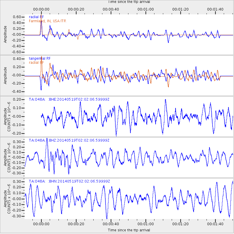
O48A Farmland, IN, USA - Earthquake Result Viewer
*The percent match for this event was below the threshold and hence no stack was calculated.
| Earthquake location: |
Central East Pacific Rise |
| Earthquake latitude/longitude: |
-4.8/-105.5 |
| Earthquake time(UTC): |
2014/05/19 (139) 01:53:54 GMT |
| Earthquake Depth: |
10 km |
| Earthquake Magnitude: |
5.5 MWB, 5.6 MWC |
| Earthquake Catalog/Contributor: |
NEIC PDE/NEIC COMCAT |
|
| Network: |
TA USArray Transportable Network (new EarthScope stations) |
| Station: |
O48A Farmland, IN, USA |
| Lat/Lon: |
40.26 N/85.16 W |
| Elevation: |
300 m |
|
| Distance: |
48.6 deg |
| Az: |
20.833 deg |
| Baz: |
207.59 deg |
| Ray Param: |
$rayparam |
*The percent match for this event was below the threshold and hence was not used in the summary stack. |
|
| Radial Match: |
58.531723 % |
| Radial Bump: |
400 |
| Transverse Match: |
60.3622 % |
| Transverse Bump: |
400 |
| SOD ConfigId: |
626651 |
| Insert Time: |
2014-06-25 19:10:27.802 +0000 |
| GWidth: |
2.5 |
| Max Bumps: |
400 |
| Tol: |
0.001 |
|
Signal To Noise
| Channel | StoN | STA | LTA |
| TA:O48A: :BHZ:20140519T02:02:06.59999Z | 2.9236956 | 1.7308957E-7 | 5.9202325E-8 |
| TA:O48A: :BHN:20140519T02:02:06.59999Z | 0.8387819 | 7.880589E-8 | 9.3952785E-8 |
| TA:O48A: :BHE:20140519T02:02:06.59999Z | 1.2313478 | 7.478624E-8 | 6.0735275E-8 |
| Arrivals |
| Ps | |
| PpPs | |
| PsPs/PpSs | |


