You are here: Home > Network List > TA - USArray Transportable Network (new EarthScope stations) Stations List
> Station T59A Double 'B' Farms, VA, USA > Earthquake Result Viewer
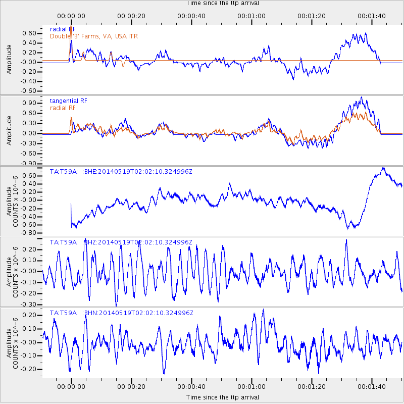
T59A Double 'B' Farms, VA, USA - Earthquake Result Viewer
*The percent match for this event was below the threshold and hence no stack was calculated.
| Earthquake location: |
Central East Pacific Rise |
| Earthquake latitude/longitude: |
-4.8/-105.5 |
| Earthquake time(UTC): |
2014/05/19 (139) 01:53:54 GMT |
| Earthquake Depth: |
10 km |
| Earthquake Magnitude: |
5.5 MWB, 5.6 MWC |
| Earthquake Catalog/Contributor: |
NEIC PDE/NEIC COMCAT |
|
| Network: |
TA USArray Transportable Network (new EarthScope stations) |
| Station: |
T59A Double 'B' Farms, VA, USA |
| Lat/Lon: |
36.97 N/77.55 W |
| Elevation: |
63 m |
|
| Distance: |
49.1 deg |
| Az: |
29.843 deg |
| Baz: |
218.26 deg |
| Ray Param: |
$rayparam |
*The percent match for this event was below the threshold and hence was not used in the summary stack. |
|
| Radial Match: |
31.495926 % |
| Radial Bump: |
400 |
| Transverse Match: |
26.332457 % |
| Transverse Bump: |
400 |
| SOD ConfigId: |
626651 |
| Insert Time: |
2014-06-25 19:11:55.955 +0000 |
| GWidth: |
2.5 |
| Max Bumps: |
400 |
| Tol: |
0.001 |
|
Signal To Noise
| Channel | StoN | STA | LTA |
| TA:T59A: :BHZ:20140519T02:02:10.324996Z | 1.459477 | 1.3073328E-7 | 8.957544E-8 |
| TA:T59A: :BHN:20140519T02:02:10.324996Z | 2.2975788 | 1.3192107E-7 | 5.741743E-8 |
| TA:T59A: :BHE:20140519T02:02:10.324996Z | 2.142973 | 3.8536467E-7 | 1.7982714E-7 |
| Arrivals |
| Ps | |
| PpPs | |
| PsPs/PpSs | |


