You are here: Home > Network List > UW - Pacific Northwest Regional Seismic Network Stations List
> Station LEBA Lebam, WA, USA > Earthquake Result Viewer
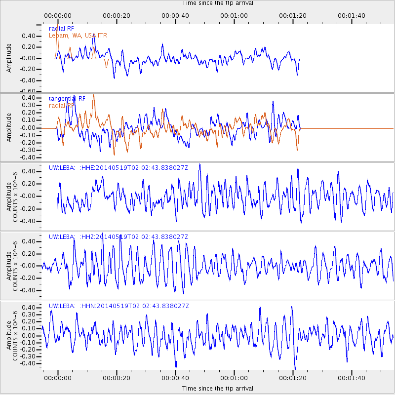
LEBA Lebam, WA, USA - Earthquake Result Viewer
*The percent match for this event was below the threshold and hence no stack was calculated.
| Earthquake location: |
Central East Pacific Rise |
| Earthquake latitude/longitude: |
-4.8/-105.5 |
| Earthquake time(UTC): |
2014/05/19 (139) 01:53:54 GMT |
| Earthquake Depth: |
10 km |
| Earthquake Magnitude: |
5.5 MWB, 5.6 MWC |
| Earthquake Catalog/Contributor: |
NEIC PDE/NEIC COMCAT |
|
| Network: |
UW Pacific Northwest Regional Seismic Network |
| Station: |
LEBA Lebam, WA, USA |
| Lat/Lon: |
46.55 N/123.56 W |
| Elevation: |
73 m |
|
| Distance: |
53.5 deg |
| Az: |
344.608 deg |
| Baz: |
157.465 deg |
| Ray Param: |
$rayparam |
*The percent match for this event was below the threshold and hence was not used in the summary stack. |
|
| Radial Match: |
61.83162 % |
| Radial Bump: |
400 |
| Transverse Match: |
59.59409 % |
| Transverse Bump: |
400 |
| SOD ConfigId: |
626651 |
| Insert Time: |
2014-06-25 19:16:42.692 +0000 |
| GWidth: |
2.5 |
| Max Bumps: |
400 |
| Tol: |
0.001 |
|
Signal To Noise
| Channel | StoN | STA | LTA |
| UW:LEBA: :HHZ:20140519T02:02:43.838027Z | 1.5332366 | 1.5477198E-7 | 1.0094462E-7 |
| UW:LEBA: :HHN:20140519T02:02:43.838027Z | 1.0304189 | 1.2128255E-7 | 1.17702186E-7 |
| UW:LEBA: :HHE:20140519T02:02:43.838027Z | 1.0192766 | 1.478899E-7 | 1.45093E-7 |
| Arrivals |
| Ps | |
| PpPs | |
| PsPs/PpSs | |


