You are here: Home > Network List > UW - Pacific Northwest Regional Seismic Network Stations List
> Station PASS Maple Falls, WA, USA > Earthquake Result Viewer
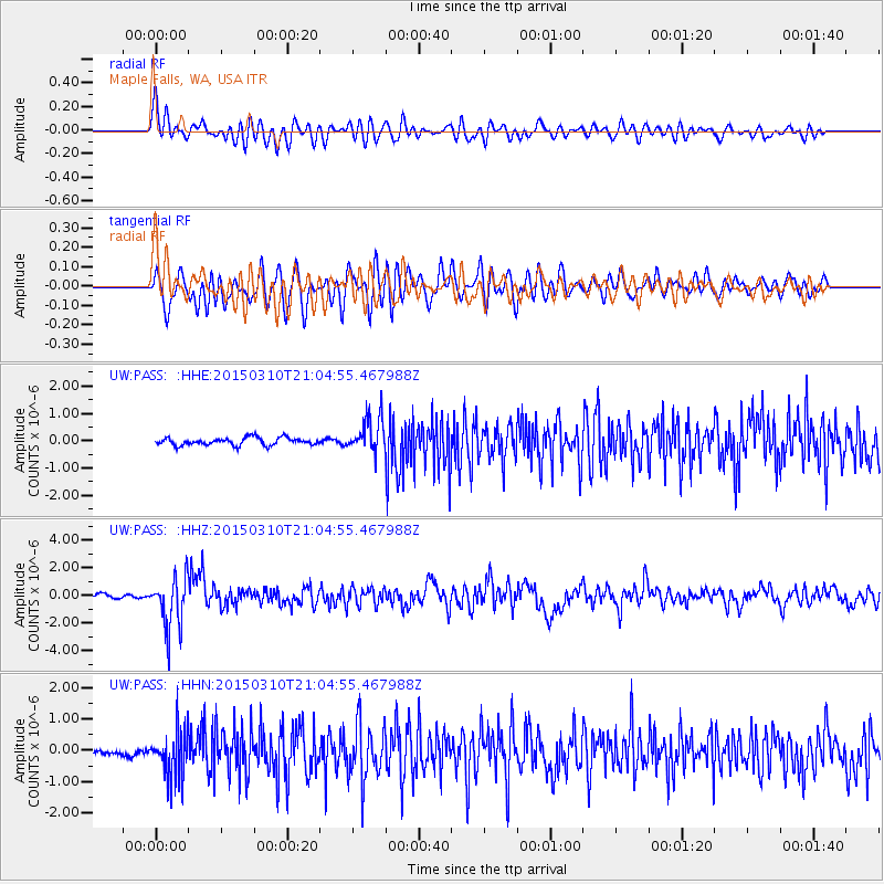
PASS Maple Falls, WA, USA - Earthquake Result Viewer
*The percent match for this event was below the threshold and hence no stack was calculated.
| Earthquake location: |
Northern Colombia |
| Earthquake latitude/longitude: |
6.8/-73.0 |
| Earthquake time(UTC): |
2015/03/10 (069) 20:55:43 GMT |
| Earthquake Depth: |
147 km |
| Earthquake Magnitude: |
6.2 MWB |
| Earthquake Catalog/Contributor: |
NEIC PDE/NEIC COMCAT |
|
| Network: |
UW Pacific Northwest Regional Seismic Network |
| Station: |
PASS Maple Falls, WA, USA |
| Lat/Lon: |
49.00 N/122.09 W |
| Elevation: |
174 m |
|
| Distance: |
58.9 deg |
| Az: |
324.449 deg |
| Baz: |
118.758 deg |
| Ray Param: |
$rayparam |
*The percent match for this event was below the threshold and hence was not used in the summary stack. |
|
| Radial Match: |
75.239586 % |
| Radial Bump: |
400 |
| Transverse Match: |
71.65714 % |
| Transverse Bump: |
400 |
| SOD ConfigId: |
7019011 |
| Insert Time: |
2019-04-17 07:04:26.981 +0000 |
| GWidth: |
2.5 |
| Max Bumps: |
400 |
| Tol: |
0.001 |
|
Signal To Noise
| Channel | StoN | STA | LTA |
| UW:PASS: :HHZ:20150310T21:04:55.467988Z | 9.261209 | 1.8701438E-6 | 2.0193303E-7 |
| UW:PASS: :HHN:20150310T21:04:55.467988Z | 6.2270875 | 7.4581385E-7 | 1.1976928E-7 |
| UW:PASS: :HHE:20150310T21:04:55.467988Z | 5.0569577 | 6.8422105E-7 | 1.3530291E-7 |
| Arrivals |
| Ps | |
| PpPs | |
| PsPs/PpSs | |


