
SUR Sutherland, South Africa - Earthquake Result Viewer
| ||||||||||||||||||
| ||||||||||||||||||
| ||||||||||||||||||
|
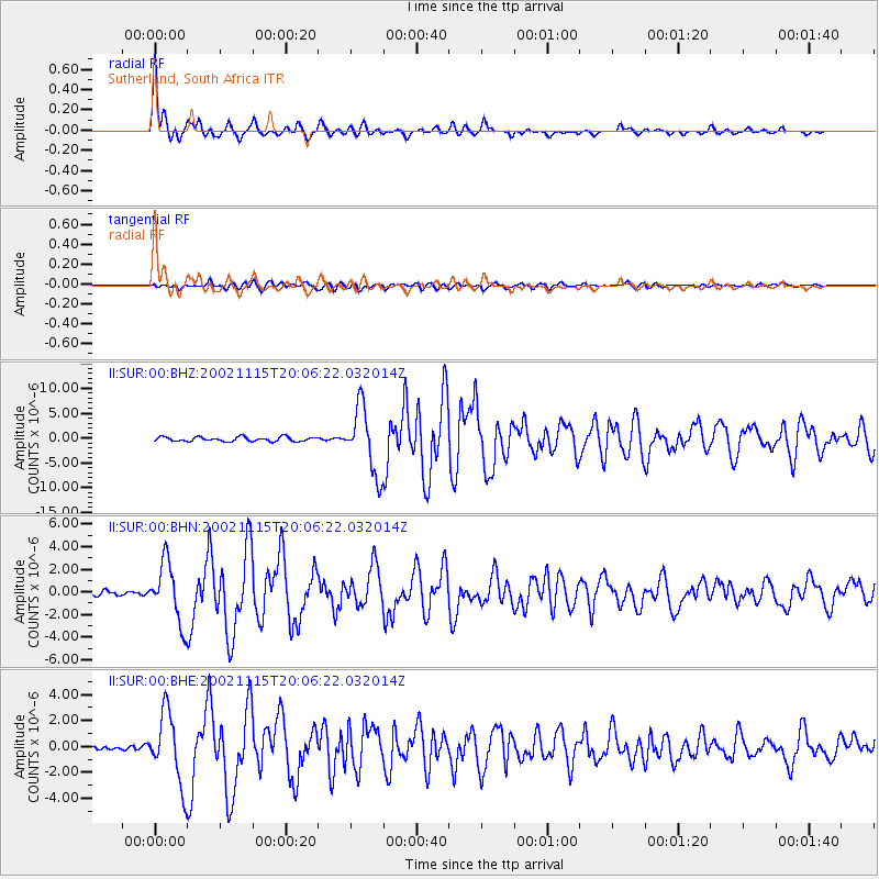
Signal To Noise
| Channel | StoN | STA | LTA |
| II:SUR:00:BHN:20021115T20:06:22.032014Z | 8.726591 | 2.667876E-6 | 3.05718E-7 |
| II:SUR:00:BHE:20021115T20:06:22.032014Z | 8.782498 | 2.747475E-6 | 3.1283523E-7 |
| II:SUR:00:BHZ:20021115T20:06:22.032014Z | 15.239064 | 6.651988E-6 | 4.3650894E-7 |
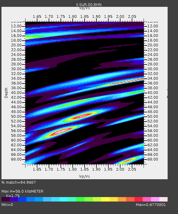
| Arrivals | |
| Ps | 6.9 SECOND |
| PpPs | 22 SECOND |
| PsPs/PpSs | 29 SECOND |

