SUR Sutherland, South Africa - Earthquake Result Viewer
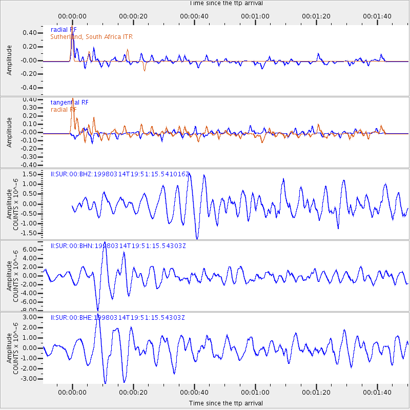
Earthquake location: Northern And Central Iran
Earthquake latitude/longitude: 30.2/57.6
Earthquake time(UTC): 1998/03/14 (073) 19:40:27 GMT
Earthquake Depth: 9.0 km
Earthquake Magnitude: 5.9 MB, 6.9 MS, 6.6 UNKNOWN, 6.3 ME
Earthquake Catalog/Contributor: WHDF/NEIC
Network: II Global Seismograph Network (GSN - IRIS/IDA)
Station: SUR Sutherland, South Africa
Lat/Lon: 32.38 S/20.81 E
Elevation: 1770 m
Distance: 71.3 deg
Az: 212.344 deg
Baz: 33.206 deg
Ray Param: 0.054418284
Estimated Moho Depth: 66.25 km
Estimated Crust Vp/Vs: 1.68
Assumed Crust Vp: 6.51 km/s
Estimated Crust Vs: 3.887 km/s
Estimated Crust Poisson's Ratio: 0.22
Radial Match: 84.463486 %
Radial Bump: 400
Transverse Match: 66.75214 %
Transverse Bump: 400
SOD ConfigId: 4480
Insert Time: 2010-03-01 23:00:57.807 +0000
GWidth: 2.5
Max Bumps: 400
Tol: 0.001

Signal To Noise

ChannelStoNSTALTA
II:SUR:00:BHN:19980314T19:51:15.54303Z2.37771961.4474446E-66.087532E-7
II:SUR:00:BHE:19980314T19:51:15.54303Z2.5465867.9171986E-73.1089462E-7
II:SUR:00:BHZ:19980314T19:51:15.541016Z2.48413237.319935E-72.946677E-7
Arrivals
Ps7.1 SECOND
PpPs26 SECOND
PsPs/PpSs33 SECOND