
SUR Sutherland, South Africa - Earthquake Result Viewer

| ||||||||||||||||||
| ||||||||||||||||||
| ||||||||||||||||||
|
Signal To Noise
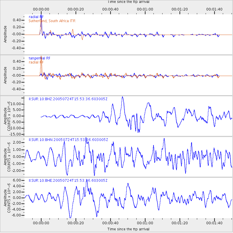
| Channel | StoN | STA | LTA |
| II:SUR:10:BHN:20050724T15:53:36.603005Z | 1.1072584 | 5.815589E-7 | 5.252242E-7 |
| II:SUR:10:BHE:20050724T15:53:36.603005Z | 1.4446355 | 1.0583511E-6 | 7.3260776E-7 |
| II:SUR:10:BHZ:20050724T15:53:36.603005Z | 2.448074 | 1.7317157E-6 | 7.073788E-7 |
| Arrivals | |
| Ps | 5.0 SECOND |
| PpPs | 14 SECOND |
| PsPs/PpSs | 19 SECOND |

