SUR Sutherland, South Africa - Earthquake Result Viewer
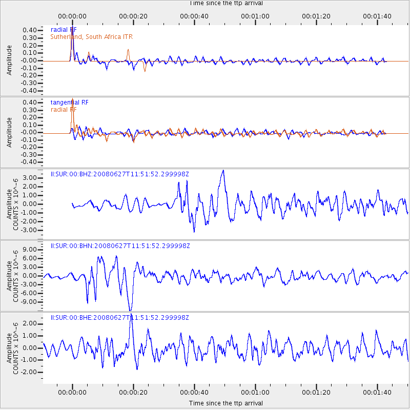
Earthquake location: Andaman Islands, India Region
Earthquake latitude/longitude: 11.0/91.8
Earthquake time(UTC): 2008/06/27 (179) 11:40:13 GMT
Earthquake Depth: 17 km
Earthquake Magnitude: 6.4 MB, 6.7 MS, 6.6 MW, 6.6 MW
Earthquake Catalog/Contributor: WHDF/NEIC
Network: II Global Seismograph Network (GSN - IRIS/IDA)
Station: SUR Sutherland, South Africa
Lat/Lon: 32.38 S/20.81 E
Elevation: 1770 m
Distance: 80.3 deg
Az: 234.273 deg
Baz: 70.392 deg
Ray Param: 0.0483873
Estimated Moho Depth: 31.75 km
Estimated Crust Vp/Vs: 2.10
Assumed Crust Vp: 6.51 km/s
Estimated Crust Vs: 3.104 km/s
Estimated Crust Poisson's Ratio: 0.35
Radial Match: 89.946526 %
Radial Bump: 400
Transverse Match: 73.403694 %
Transverse Bump: 400
SOD ConfigId: 2504
Insert Time: 2010-03-01 23:01:17.213 +0000
GWidth: 2.5
Max Bumps: 400
Tol: 0.001

Signal To Noise

ChannelStoNSTALTA
II:SUR:00:BHN:20080627T11:51:52.299998Z3.93685631.815053E-64.6104122E-7
II:SUR:00:BHE:20080627T11:51:52.299998Z2.1563235.559216E-72.5781E-7
II:SUR:00:BHZ:20080627T11:51:52.299998Z1.36420646.1579374E-74.5139336E-7
Arrivals
Ps5.5 SECOND
PpPs15 SECOND
PsPs/PpSs20 SECOND