
SUR Sutherland, South Africa - Earthquake Result Viewer
| ||||||||||||||||||
| ||||||||||||||||||
| ||||||||||||||||||
|
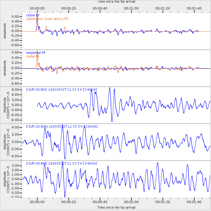
Signal To Noise
| Channel | StoN | STA | LTA |
| II:SUR:00:BHN:19930502T11:33:54.534009Z | 4.004494 | 1.8473844E-6 | 4.613278E-7 |
| II:SUR:00:BHE:19930502T11:33:54.534009Z | 3.681238 | 1.6405227E-6 | 4.456443E-7 |
| II:SUR:00:BHZ:19930502T11:33:54.534009Z | 4.419659 | 4.4549633E-6 | 1.007988E-6 |
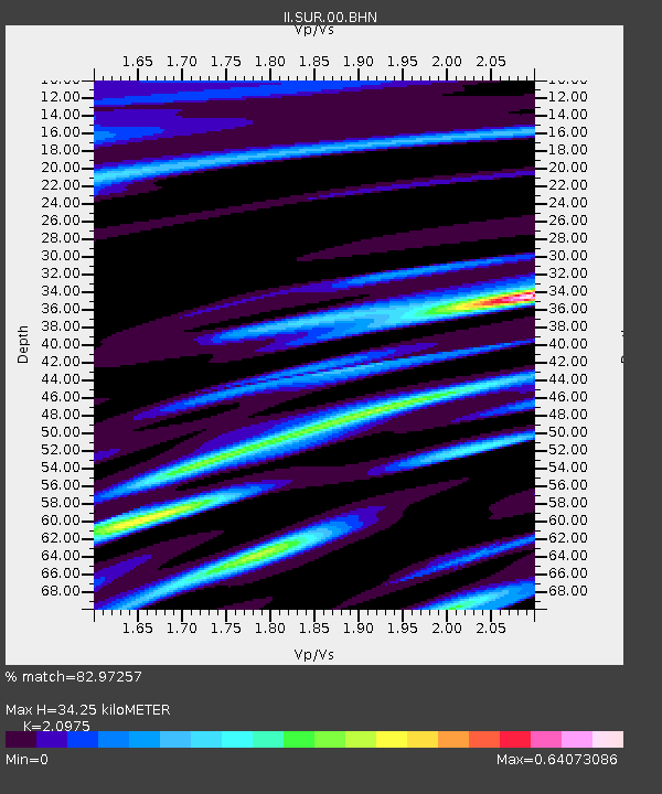
| Arrivals | |
| Ps | 6.1 SECOND |
| PpPs | 15 SECOND |
| PsPs/PpSs | 21 SECOND |

