
SUR Sutherland, South Africa - Earthquake Result Viewer
| ||||||||||||||||||
| ||||||||||||||||||
| ||||||||||||||||||
|
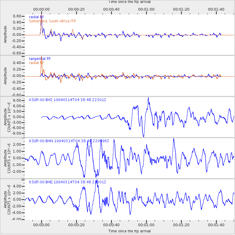
Signal To Noise
| Channel | StoN | STA | LTA |
| II:SUR:00:BHN:19940314T04:38:48.220996Z | 2.0062904 | 7.5341967E-7 | 3.7552874E-7 |
| II:SUR:00:BHE:19940314T04:38:48.22301Z | 1.2947783 | 7.430512E-7 | 5.738829E-7 |
| II:SUR:00:BHZ:19940314T04:38:48.22301Z | 1.1613116 | 5.976722E-7 | 5.146527E-7 |
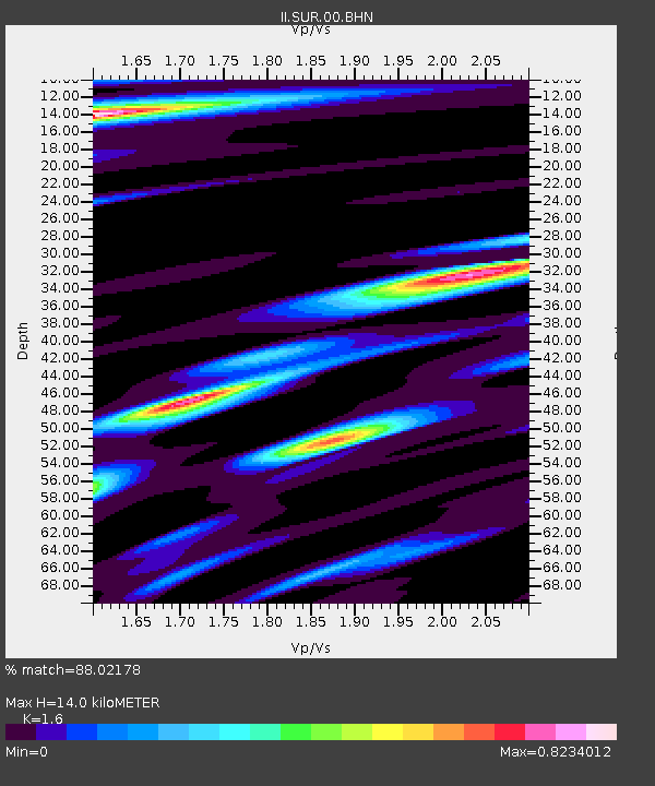
| Arrivals | |
| Ps | 1.4 SECOND |
| PpPs | 5.2 SECOND |
| PsPs/PpSs | 6.6 SECOND |

