
SUR Sutherland, South Africa - Earthquake Result Viewer
| ||||||||||||||||||
| ||||||||||||||||||
| ||||||||||||||||||
|
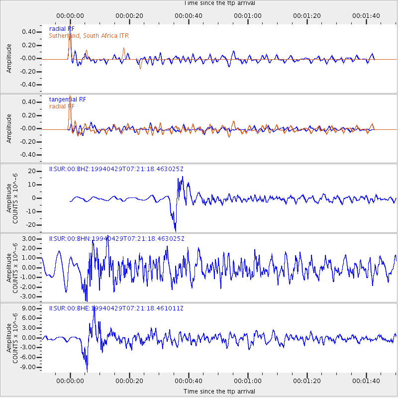
Signal To Noise
| Channel | StoN | STA | LTA |
| II:SUR:00:BHN:19940429T07:21:18.463025Z | 1.425915 | 1.068921E-6 | 7.496387E-7 |
| II:SUR:00:BHE:19940429T07:21:18.461011Z | 4.59578 | 2.0437722E-6 | 4.4470625E-7 |
| II:SUR:00:BHZ:19940429T07:21:18.463025Z | 5.2282863 | 5.3037784E-6 | 1.0144391E-6 |
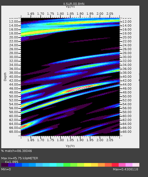
| Arrivals | |
| Ps | 6.5 SECOND |
| PpPs | 20 SECOND |
| PsPs/PpSs | 26 SECOND |

