SUR Sutherland, South Africa - Earthquake Result Viewer
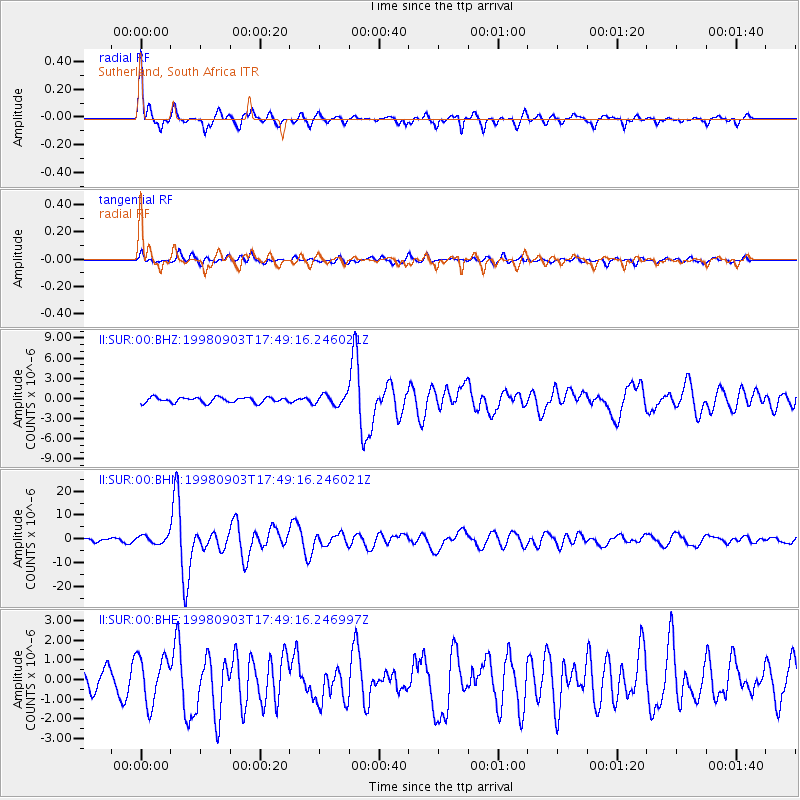
Earthquake location: Near Coast Of Central Chile
Earthquake latitude/longitude: -29.5/-71.7
Earthquake time(UTC): 1998/09/03 (246) 17:37:58 GMT
Earthquake Depth: 27 km
Earthquake Magnitude: 6.2 MB, 6.6 MS, 6.5 UNKNOWN, 6.4 ME
Earthquake Catalog/Contributor: WHDF/NEIC
Network: II Global Seismograph Network (GSN - IRIS/IDA)
Station: SUR Sutherland, South Africa
Lat/Lon: 32.38 S/20.81 E
Elevation: 1770 m
Distance: 76.8 deg
Az: 119.748 deg
Baz: 243.502 deg
Ray Param: 0.050710402
Estimated Moho Depth: 41.75 km
Estimated Crust Vp/Vs: 1.84
Assumed Crust Vp: 6.51 km/s
Estimated Crust Vs: 3.533 km/s
Estimated Crust Poisson's Ratio: 0.29
Radial Match: 91.71391 %
Radial Bump: 364
Transverse Match: 66.424065 %
Transverse Bump: 400
SOD ConfigId: 4480
Insert Time: 2010-03-01 23:02:05.721 +0000
GWidth: 2.5
Max Bumps: 400
Tol: 0.001

Signal To Noise

ChannelStoNSTALTA
II:SUR:00:BHN:19980903T17:49:16.246021Z3.43841391.6557594E-64.815475E-7
II:SUR:00:BHE:19980903T17:49:16.246997Z2.37352371.1880661E-65.0054945E-7
II:SUR:00:BHZ:19980903T17:49:16.246021Z1.93464827.559082E-73.9072128E-7
Arrivals
Ps5.6 SECOND
PpPs18 SECOND
PsPs/PpSs23 SECOND