You are here: Home > Network List > II - Global Seismograph Network (GSN - IRIS/IDA) Stations List
> Station SUR Sutherland, South Africa > Earthquake Result Viewer
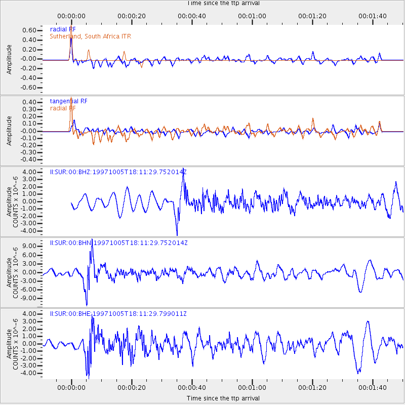
SUR Sutherland, South Africa - Earthquake Result Viewer
*The percent match for this event was below the threshold and hence no stack was calculated.
| Earthquake location: |
South Sandwich Islands Region |
| Earthquake latitude/longitude: |
-59.7/-29.2 |
| Earthquake time(UTC): |
1997/10/05 (278) 18:04:30 GMT |
| Earthquake Depth: |
274 km |
| Earthquake Magnitude: |
6.0 MB, 6.3 UNKNOWN, 6.3 MW |
| Earthquake Catalog/Contributor: |
WHDF/NEIC |
|
| Network: |
II Global Seismograph Network (GSN - IRIS/IDA) |
| Station: |
SUR Sutherland, South Africa |
| Lat/Lon: |
32.38 S/20.81 E |
| Elevation: |
1770 m |
|
| Distance: |
42.7 deg |
| Az: |
72.939 deg |
| Baz: |
214.905 deg |
| Ray Param: |
$rayparam |
*The percent match for this event was below the threshold and hence was not used in the summary stack. |
|
| Radial Match: |
68.871254 % |
| Radial Bump: |
400 |
| Transverse Match: |
50.291485 % |
| Transverse Bump: |
400 |
| SOD ConfigId: |
4480 |
| Insert Time: |
2010-03-01 23:02:19.004 +0000 |
| GWidth: |
2.5 |
| Max Bumps: |
400 |
| Tol: |
0.001 |
|
Signal To Noise
| Channel | StoN | STA | LTA |
| II:SUR:00:BHN:19971005T18:11:29.752014Z | 2.3809602 | 2.6053287E-6 | 1.0942344E-6 |
| II:SUR:00:BHE:19971005T18:11:29.799011Z | 1.5228633 | 7.33379E-7 | 4.8157904E-7 |
| II:SUR:00:BHZ:19971005T18:11:29.752014Z | 0.9455557 | 8.7050233E-7 | 9.2062515E-7 |
| Arrivals |
| Ps | |
| PpPs | |
| PsPs/PpSs | |


