You are here: Home > Network List > II - Global Seismograph Network (GSN - IRIS/IDA) Stations List
> Station SUR Sutherland, South Africa > Earthquake Result Viewer
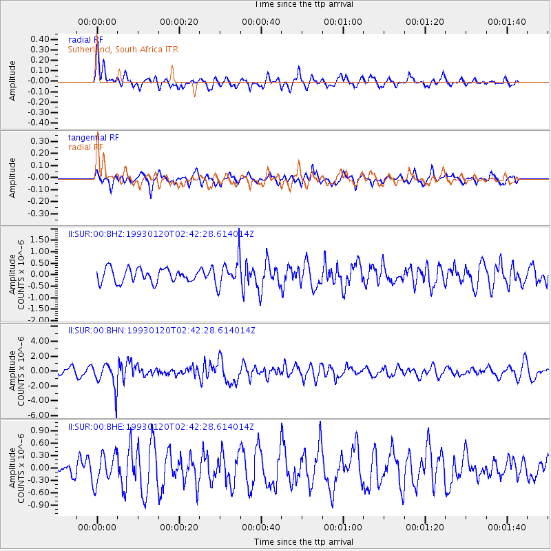
SUR Sutherland, South Africa - Earthquake Result Viewer
*The percent match for this event was below the threshold and hence no stack was calculated.
| Earthquake location: |
Northern Sumatra, Indonesia |
| Earthquake latitude/longitude: |
3.1/97.7 |
| Earthquake time(UTC): |
1993/01/20 (020) 02:30:55 GMT |
| Earthquake Depth: |
71 km |
| Earthquake Magnitude: |
6.2 MB |
| Earthquake Catalog/Contributor: |
WHDF/NEIC |
|
| Network: |
II Global Seismograph Network (GSN - IRIS/IDA) |
| Station: |
SUR Sutherland, South Africa |
| Lat/Lon: |
32.38 S/20.81 E |
| Elevation: |
1770 m |
|
| Distance: |
80.6 deg |
| Az: |
236.641 deg |
| Baz: |
80.311 deg |
| Ray Param: |
$rayparam |
*The percent match for this event was below the threshold and hence was not used in the summary stack. |
|
| Radial Match: |
60.86043 % |
| Radial Bump: |
400 |
| Transverse Match: |
60.243553 % |
| Transverse Bump: |
400 |
| SOD ConfigId: |
4480 |
| Insert Time: |
2010-03-01 23:02:33.277 +0000 |
| GWidth: |
2.5 |
| Max Bumps: |
400 |
| Tol: |
0.001 |
|
Signal To Noise
| Channel | StoN | STA | LTA |
| II:SUR:00:BHN:19930120T02:42:28.614014Z | 3.6018307 | 1.7897898E-6 | 4.969111E-7 |
| II:SUR:00:BHE:19930120T02:42:28.614014Z | 1.0137148 | 3.5119157E-7 | 3.4644023E-7 |
| II:SUR:00:BHZ:19930120T02:42:28.614014Z | 2.102474 | 6.137496E-7 | 2.9191781E-7 |
| Arrivals |
| Ps | |
| PpPs | |
| PsPs/PpSs | |


