You are here: Home > Network List > TA - USArray Transportable Network (new EarthScope stations) Stations List
> Station I23K Minto, Yukon-Koyukuk, AK, USA > Earthquake Result Viewer
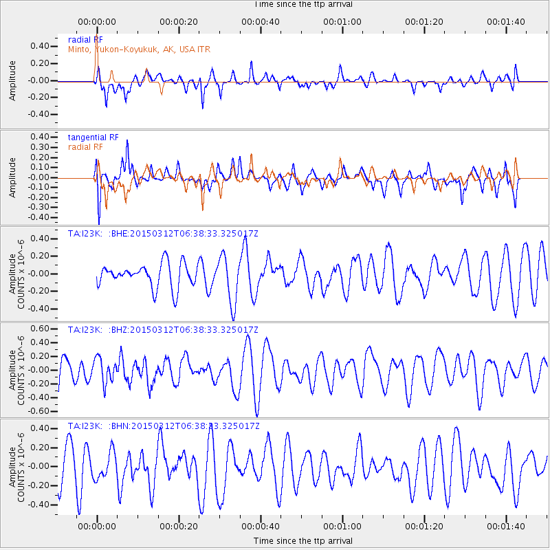
I23K Minto, Yukon-Koyukuk, AK, USA - Earthquake Result Viewer
*The percent match for this event was below the threshold and hence no stack was calculated.
| Earthquake location: |
Mariana Islands |
| Earthquake latitude/longitude: |
13.2/145.4 |
| Earthquake time(UTC): |
2015/03/12 (071) 06:28:10 GMT |
| Earthquake Depth: |
44 km |
| Earthquake Magnitude: |
5.0 mb |
| Earthquake Catalog/Contributor: |
ISC/ISC |
|
| Network: |
TA USArray Transportable Network (new EarthScope stations) |
| Station: |
I23K Minto, Yukon-Koyukuk, AK, USA |
| Lat/Lon: |
65.15 N/149.36 W |
| Elevation: |
149 m |
|
| Distance: |
67.8 deg |
| Az: |
24.495 deg |
| Baz: |
252.829 deg |
| Ray Param: |
$rayparam |
*The percent match for this event was below the threshold and hence was not used in the summary stack. |
|
| Radial Match: |
55.15133 % |
| Radial Bump: |
400 |
| Transverse Match: |
52.674744 % |
| Transverse Bump: |
400 |
| SOD ConfigId: |
7019011 |
| Insert Time: |
2019-04-17 07:38:36.448 +0000 |
| GWidth: |
2.5 |
| Max Bumps: |
400 |
| Tol: |
0.001 |
|
Signal To Noise
| Channel | StoN | STA | LTA |
| TA:I23K: :BHZ:20150312T06:38:33.325017Z | 1.1250647 | 1.7778561E-7 | 1.5802256E-7 |
| TA:I23K: :BHN:20150312T06:38:33.325017Z | 0.68083346 | 1.4097199E-7 | 2.0705797E-7 |
| TA:I23K: :BHE:20150312T06:38:33.325017Z | 2.017571 | 2.6956715E-7 | 1.3360976E-7 |
| Arrivals |
| Ps | |
| PpPs | |
| PsPs/PpSs | |


