You are here: Home > Network List > II - Global Seismograph Network (GSN - IRIS/IDA) Stations List
> Station SUR Sutherland, South Africa > Earthquake Result Viewer
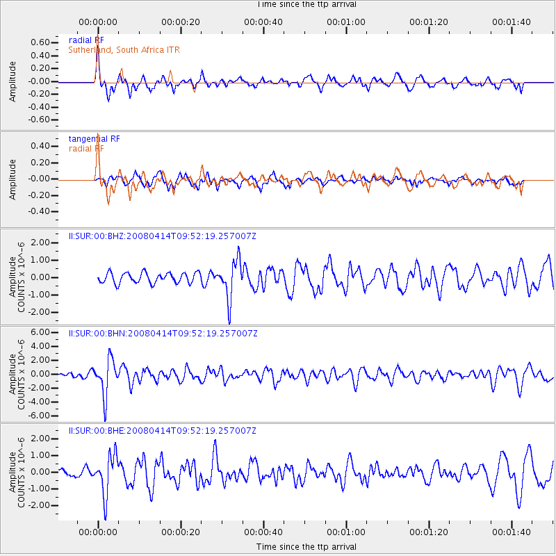
SUR Sutherland, South Africa - Earthquake Result Viewer
*The percent match for this event was below the threshold and hence no stack was calculated.
| Earthquake location: |
South Sandwich Islands Region |
| Earthquake latitude/longitude: |
-56.0/-28.0 |
| Earthquake time(UTC): |
2008/04/14 (105) 09:45:19 GMT |
| Earthquake Depth: |
140 km |
| Earthquake Magnitude: |
6.0 MB, 6.0 MW, 6.0 MW |
| Earthquake Catalog/Contributor: |
WHDF/NEIC |
|
| Network: |
II Global Seismograph Network (GSN - IRIS/IDA) |
| Station: |
SUR Sutherland, South Africa |
| Lat/Lon: |
32.38 S/20.81 E |
| Elevation: |
1770 m |
|
| Distance: |
41.1 deg |
| Az: |
75.772 deg |
| Baz: |
220.031 deg |
| Ray Param: |
$rayparam |
*The percent match for this event was below the threshold and hence was not used in the summary stack. |
|
| Radial Match: |
65.87293 % |
| Radial Bump: |
400 |
| Transverse Match: |
57.634827 % |
| Transverse Bump: |
400 |
| SOD ConfigId: |
2504 |
| Insert Time: |
2010-03-01 23:02:57.639 +0000 |
| GWidth: |
2.5 |
| Max Bumps: |
400 |
| Tol: |
0.001 |
|
Signal To Noise
| Channel | StoN | STA | LTA |
| II:SUR:00:BHN:20080414T09:52:19.257007Z | 8.844895 | 2.6384555E-6 | 2.983026E-7 |
| II:SUR:00:BHE:20080414T09:52:19.257007Z | 3.9761646 | 1.2111498E-6 | 3.0460254E-7 |
| II:SUR:00:BHZ:20080414T09:52:19.257007Z | 3.7920501 | 1.1193696E-6 | 2.951885E-7 |
| Arrivals |
| Ps | |
| PpPs | |
| PsPs/PpSs | |


