You are here: Home > Network List > UW - Pacific Northwest Regional Seismic Network Stations List
> Station UMAT Pilot Rock, OR, USA > Earthquake Result Viewer
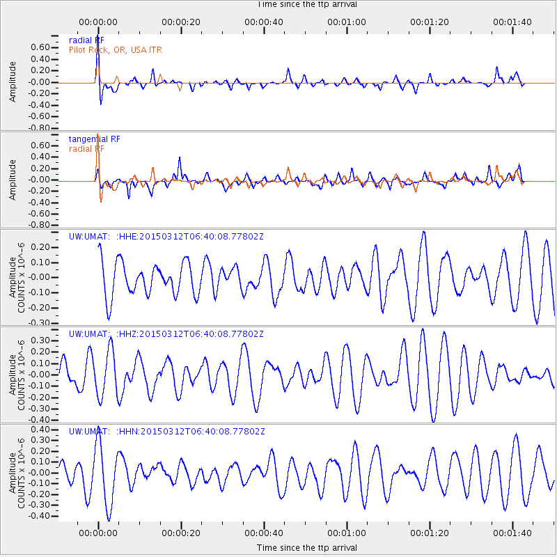
UMAT Pilot Rock, OR, USA - Earthquake Result Viewer
*The percent match for this event was below the threshold and hence no stack was calculated.
| Earthquake location: |
Mariana Islands |
| Earthquake latitude/longitude: |
13.2/145.4 |
| Earthquake time(UTC): |
2015/03/12 (071) 06:28:10 GMT |
| Earthquake Depth: |
44 km |
| Earthquake Magnitude: |
5.0 mb |
| Earthquake Catalog/Contributor: |
ISC/ISC |
|
| Network: |
UW Pacific Northwest Regional Seismic Network |
| Station: |
UMAT Pilot Rock, OR, USA |
| Lat/Lon: |
45.29 N/118.96 W |
| Elevation: |
1318 m |
|
| Distance: |
84.7 deg |
| Az: |
44.871 deg |
| Baz: |
283.266 deg |
| Ray Param: |
$rayparam |
*The percent match for this event was below the threshold and hence was not used in the summary stack. |
|
| Radial Match: |
61.208614 % |
| Radial Bump: |
400 |
| Transverse Match: |
64.15528 % |
| Transverse Bump: |
400 |
| SOD ConfigId: |
7019011 |
| Insert Time: |
2019-04-17 07:39:19.150 +0000 |
| GWidth: |
2.5 |
| Max Bumps: |
400 |
| Tol: |
0.001 |
|
Signal To Noise
| Channel | StoN | STA | LTA |
| UW:UMAT: :HHZ:20150312T06:40:08.77802Z | 1.2918942 | 2.023152E-7 | 1.5660355E-7 |
| UW:UMAT: :HHN:20150312T06:40:08.77802Z | 2.3619733 | 2.8785445E-7 | 1.2187033E-7 |
| UW:UMAT: :HHE:20150312T06:40:08.77802Z | 0.55956316 | 6.074487E-8 | 1.0855765E-7 |
| Arrivals |
| Ps | |
| PpPs | |
| PsPs/PpSs | |


