You are here: Home > Network List > TA - USArray Transportable Network (new EarthScope stations) Stations List
> Station O48A Farmland, IN, USA > Earthquake Result Viewer
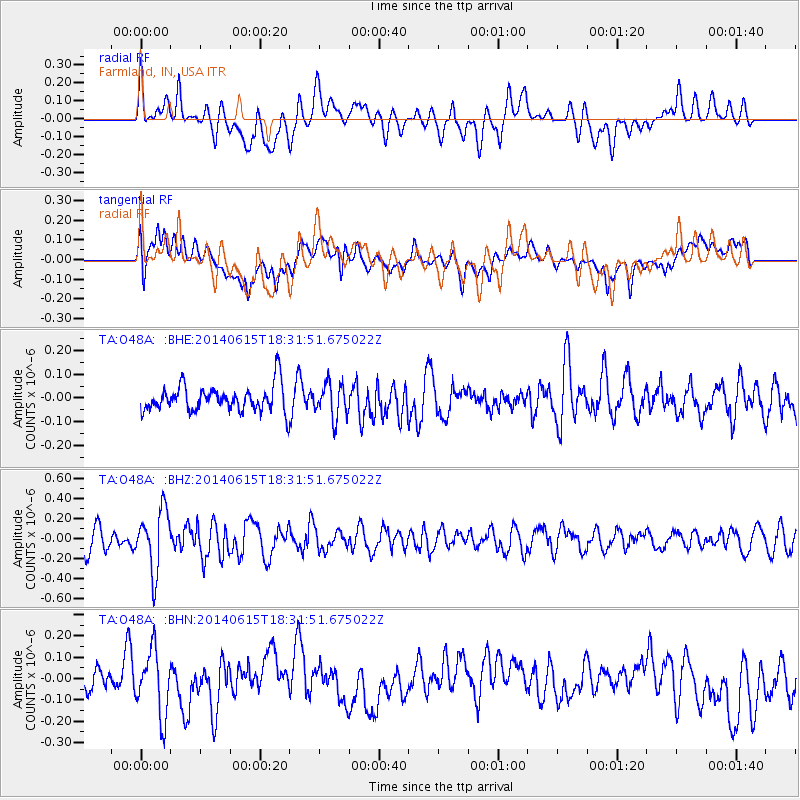
O48A Farmland, IN, USA - Earthquake Result Viewer
*The percent match for this event was below the threshold and hence no stack was calculated.
| Earthquake location: |
Near East Coast Of Honshu, Japan |
| Earthquake latitude/longitude: |
36.6/141.8 |
| Earthquake time(UTC): |
2014/06/15 (166) 18:19:15 GMT |
| Earthquake Depth: |
23 km |
| Earthquake Magnitude: |
5.7 MB |
| Earthquake Catalog/Contributor: |
NEIC PDE/NEIC COMCAT |
|
| Network: |
TA USArray Transportable Network (new EarthScope stations) |
| Station: |
O48A Farmland, IN, USA |
| Lat/Lon: |
40.26 N/85.16 W |
| Elevation: |
300 m |
|
| Distance: |
92.2 deg |
| Az: |
34.022 deg |
| Baz: |
323.983 deg |
| Ray Param: |
$rayparam |
*The percent match for this event was below the threshold and hence was not used in the summary stack. |
|
| Radial Match: |
61.47191 % |
| Radial Bump: |
400 |
| Transverse Match: |
49.166794 % |
| Transverse Bump: |
400 |
| SOD ConfigId: |
739768 |
| Insert Time: |
2014-06-29 19:09:48.247 +0000 |
| GWidth: |
2.5 |
| Max Bumps: |
400 |
| Tol: |
0.001 |
|
Signal To Noise
| Channel | StoN | STA | LTA |
| TA:O48A: :BHZ:20140615T18:31:51.675022Z | 3.5248175 | 3.045971E-7 | 8.6415E-8 |
| TA:O48A: :BHN:20140615T18:31:51.675022Z | 2.189513 | 1.5090622E-7 | 6.892228E-8 |
| TA:O48A: :BHE:20140615T18:31:51.675022Z | 1.3246977 | 7.289512E-8 | 5.5027737E-8 |
| Arrivals |
| Ps | |
| PpPs | |
| PsPs/PpSs | |


