You are here: Home > Network List > UW - Pacific Northwest Regional Seismic Network Stations List
> Station LEBA Lebam, WA, USA > Earthquake Result Viewer
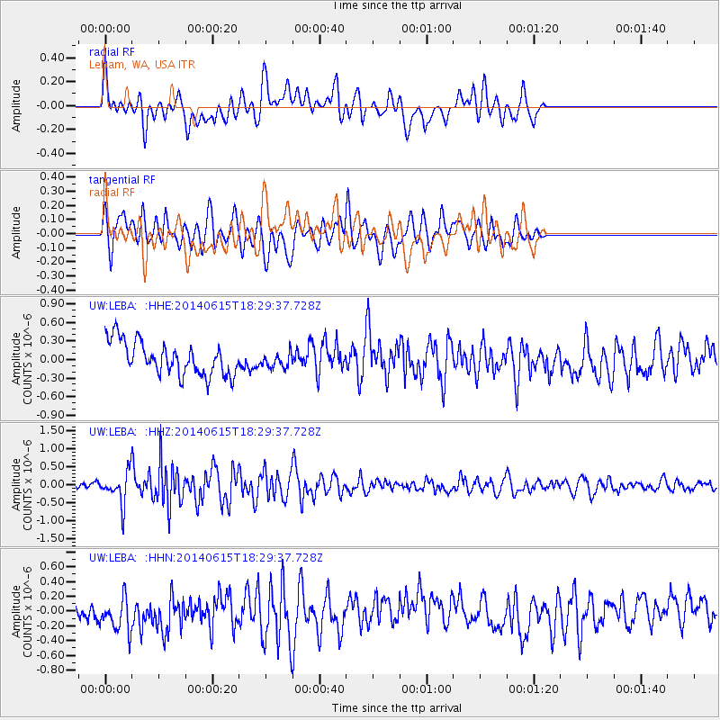
LEBA Lebam, WA, USA - Earthquake Result Viewer
*The percent match for this event was below the threshold and hence no stack was calculated.
| Earthquake location: |
Near East Coast Of Honshu, Japan |
| Earthquake latitude/longitude: |
36.6/141.8 |
| Earthquake time(UTC): |
2014/06/15 (166) 18:19:15 GMT |
| Earthquake Depth: |
23 km |
| Earthquake Magnitude: |
5.7 MB |
| Earthquake Catalog/Contributor: |
NEIC PDE/NEIC COMCAT |
|
| Network: |
UW Pacific Northwest Regional Seismic Network |
| Station: |
LEBA Lebam, WA, USA |
| Lat/Lon: |
46.55 N/123.56 W |
| Elevation: |
73 m |
|
| Distance: |
67.4 deg |
| Az: |
48.19 deg |
| Baz: |
299.708 deg |
| Ray Param: |
$rayparam |
*The percent match for this event was below the threshold and hence was not used in the summary stack. |
|
| Radial Match: |
55.297764 % |
| Radial Bump: |
400 |
| Transverse Match: |
46.900074 % |
| Transverse Bump: |
400 |
| SOD ConfigId: |
739768 |
| Insert Time: |
2014-06-29 19:18:57.048 +0000 |
| GWidth: |
2.5 |
| Max Bumps: |
400 |
| Tol: |
0.001 |
|
Signal To Noise
| Channel | StoN | STA | LTA |
| UW:LEBA: :HHZ:20140615T18:29:37.728Z | 3.3748226 | 4.3467193E-7 | 1.2879845E-7 |
| UW:LEBA: :HHN:20140615T18:29:37.728Z | 1.5337896 | 2.6327453E-7 | 1.716497E-7 |
| UW:LEBA: :HHE:20140615T18:29:37.728Z | 0.44708723 | 1.2033033E-7 | 2.6914284E-7 |
| Arrivals |
| Ps | |
| PpPs | |
| PsPs/PpSs | |


