You are here: Home > Network List > UW - Pacific Northwest Regional Seismic Network Stations List
> Station UMAT Pilot Rock, OR, USA > Earthquake Result Viewer
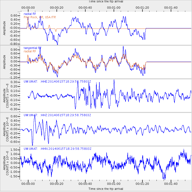
UMAT Pilot Rock, OR, USA - Earthquake Result Viewer
*The percent match for this event was below the threshold and hence no stack was calculated.
| Earthquake location: |
Near East Coast Of Honshu, Japan |
| Earthquake latitude/longitude: |
36.6/141.8 |
| Earthquake time(UTC): |
2014/06/15 (166) 18:19:15 GMT |
| Earthquake Depth: |
23 km |
| Earthquake Magnitude: |
5.7 MB |
| Earthquake Catalog/Contributor: |
NEIC PDE/NEIC COMCAT |
|
| Network: |
UW Pacific Northwest Regional Seismic Network |
| Station: |
UMAT Pilot Rock, OR, USA |
| Lat/Lon: |
45.29 N/118.96 W |
| Elevation: |
1318 m |
|
| Distance: |
70.8 deg |
| Az: |
47.555 deg |
| Baz: |
302.778 deg |
| Ray Param: |
$rayparam |
*The percent match for this event was below the threshold and hence was not used in the summary stack. |
|
| Radial Match: |
53.202007 % |
| Radial Bump: |
400 |
| Transverse Match: |
52.880684 % |
| Transverse Bump: |
400 |
| SOD ConfigId: |
739768 |
| Insert Time: |
2014-06-29 19:19:48.893 +0000 |
| GWidth: |
2.5 |
| Max Bumps: |
400 |
| Tol: |
0.001 |
|
Signal To Noise
| Channel | StoN | STA | LTA |
| UW:UMAT: :HHZ:20140615T18:29:58.75803Z | 5.9326835 | 3.343654E-7 | 5.635989E-8 |
| UW:UMAT: :HHN:20140615T18:29:58.75803Z | 0.79826474 | 4.2397352E-7 | 5.311189E-7 |
| UW:UMAT: :HHE:20140615T18:29:58.75803Z | 3.4160626 | 1.2310873E-7 | 3.6038198E-8 |
| Arrivals |
| Ps | |
| PpPs | |
| PsPs/PpSs | |


