You are here: Home > Network List > II - Global Seismograph Network (GSN - IRIS/IDA) Stations List
> Station SUR Sutherland, South Africa > Earthquake Result Viewer
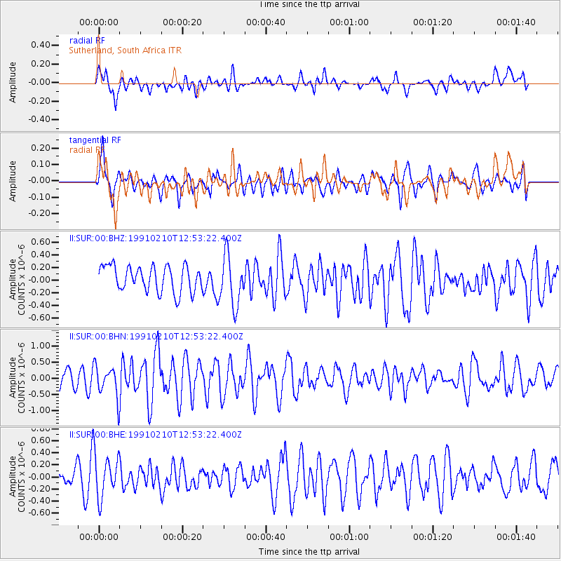
SUR Sutherland, South Africa - Earthquake Result Viewer
*The percent match for this event was below the threshold and hence no stack was calculated.
| Earthquake location: |
Central Mid-Atlantic Ridge |
| Earthquake latitude/longitude: |
8.7/-39.8 |
| Earthquake time(UTC): |
1991/02/10 (041) 12:42:37 GMT |
| Earthquake Depth: |
10 km |
| Earthquake Magnitude: |
5.9 MB, 5.8 MS, 5.8 UNKNOWN |
| Earthquake Catalog/Contributor: |
WHDF/NEIC |
|
| Network: |
II Global Seismograph Network (GSN - IRIS/IDA) |
| Station: |
SUR Sutherland, South Africa |
| Lat/Lon: |
32.38 S/20.81 E |
| Elevation: |
1770 m |
|
| Distance: |
70.7 deg |
| Az: |
128.625 deg |
| Baz: |
294.107 deg |
| Ray Param: |
$rayparam |
*The percent match for this event was below the threshold and hence was not used in the summary stack. |
|
| Radial Match: |
44.22408 % |
| Radial Bump: |
400 |
| Transverse Match: |
62.97583 % |
| Transverse Bump: |
400 |
| SOD ConfigId: |
4480 |
| Insert Time: |
2010-03-01 23:03:27.138 +0000 |
| GWidth: |
2.5 |
| Max Bumps: |
400 |
| Tol: |
0.001 |
|
Signal To Noise
| Channel | StoN | STA | LTA |
| II:SUR:00:BHN:19910210T12:53:22.400Z | 1.5895228 | 4.7394445E-7 | 2.9816775E-7 |
| II:SUR:00:BHE:19910210T12:53:22.400Z | 1.4563346 | 3.2155344E-7 | 2.207964E-7 |
| II:SUR:00:BHZ:19910210T12:53:22.400Z | 1.9890344 | 4.056031E-7 | 2.039196E-7 |
| Arrivals |
| Ps | |
| PpPs | |
| PsPs/PpSs | |


