You are here: Home > Network List > TA - USArray Transportable Network (new EarthScope stations) Stations List
> Station J04D Umpqua National Forest, Toketee, OR, USA > Earthquake Result Viewer
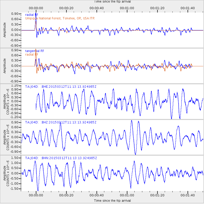
J04D Umpqua National Forest, Toketee, OR, USA - Earthquake Result Viewer
*The percent match for this event was below the threshold and hence no stack was calculated.
| Earthquake location: |
Near East Coast Of Honshu, Japan |
| Earthquake latitude/longitude: |
37.3/141.6 |
| Earthquake time(UTC): |
2015/03/12 (071) 11:02:40 GMT |
| Earthquake Depth: |
44 km |
| Earthquake Magnitude: |
5.0 MW |
| Earthquake Catalog/Contributor: |
ISC/ISC |
|
| Network: |
TA USArray Transportable Network (new EarthScope stations) |
| Station: |
J04D Umpqua National Forest, Toketee, OR, USA |
| Lat/Lon: |
43.24 N/122.11 W |
| Elevation: |
1948 m |
|
| Distance: |
69.6 deg |
| Az: |
50.8 deg |
| Baz: |
302.31 deg |
| Ray Param: |
$rayparam |
*The percent match for this event was below the threshold and hence was not used in the summary stack. |
|
| Radial Match: |
43.85466 % |
| Radial Bump: |
400 |
| Transverse Match: |
40.347755 % |
| Transverse Bump: |
400 |
| SOD ConfigId: |
7019011 |
| Insert Time: |
2019-04-17 07:53:41.438 +0000 |
| GWidth: |
2.5 |
| Max Bumps: |
400 |
| Tol: |
0.001 |
|
Signal To Noise
| Channel | StoN | STA | LTA |
| TA:J04D: :BHZ:20150312T11:13:13.924985Z | 0.8678685 | 2.8001728E-7 | 3.226494E-7 |
| TA:J04D: :BHN:20150312T11:13:13.924985Z | 2.2289295 | 9.571862E-7 | 4.2943762E-7 |
| TA:J04D: :BHE:20150312T11:13:13.924985Z | 1.4935324 | 6.416065E-7 | 4.2958996E-7 |
| Arrivals |
| Ps | |
| PpPs | |
| PsPs/PpSs | |


