You are here: Home > Network List > TA - USArray Transportable Network (new EarthScope stations) Stations List
> Station U57A Blanch, NC, USA > Earthquake Result Viewer
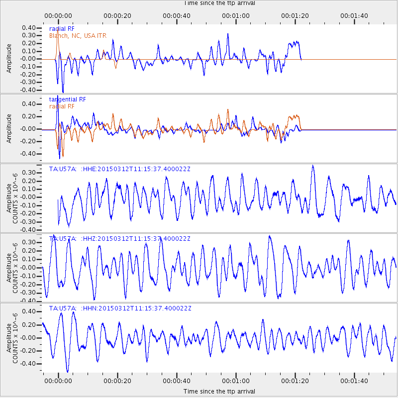
U57A Blanch, NC, USA - Earthquake Result Viewer
*The percent match for this event was below the threshold and hence no stack was calculated.
| Earthquake location: |
Near East Coast Of Honshu, Japan |
| Earthquake latitude/longitude: |
37.3/141.6 |
| Earthquake time(UTC): |
2015/03/12 (071) 11:02:40 GMT |
| Earthquake Depth: |
44 km |
| Earthquake Magnitude: |
5.0 MW |
| Earthquake Catalog/Contributor: |
ISC/ISC |
|
| Network: |
TA USArray Transportable Network (new EarthScope stations) |
| Station: |
U57A Blanch, NC, USA |
| Lat/Lon: |
36.43 N/79.34 W |
| Elevation: |
178 m |
|
| Distance: |
97.4 deg |
| Az: |
32.196 deg |
| Baz: |
328.227 deg |
| Ray Param: |
$rayparam |
*The percent match for this event was below the threshold and hence was not used in the summary stack. |
|
| Radial Match: |
51.104588 % |
| Radial Bump: |
400 |
| Transverse Match: |
48.141125 % |
| Transverse Bump: |
400 |
| SOD ConfigId: |
7019011 |
| Insert Time: |
2019-04-17 07:54:16.981 +0000 |
| GWidth: |
2.5 |
| Max Bumps: |
400 |
| Tol: |
0.001 |
|
Signal To Noise
| Channel | StoN | STA | LTA |
| TA:U57A: :HHZ:20150312T11:15:37.400022Z | 1.3271768 | 2.0169732E-7 | 1.5197472E-7 |
| TA:U57A: :HHN:20150312T11:15:37.400022Z | 2.1422927 | 2.8861385E-7 | 1.3472194E-7 |
| TA:U57A: :HHE:20150312T11:15:37.400022Z | 0.69753534 | 1.054388E-7 | 1.5115909E-7 |
| Arrivals |
| Ps | |
| PpPs | |
| PsPs/PpSs | |


