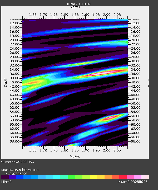
PALK Pallekele, Sri Lanka - Earthquake Result Viewer
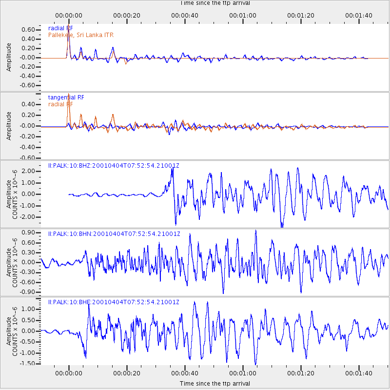
Earthquake location: Aru Islands Region, Indonesia
Earthquake latitude/longitude: -5.2/132.4
Earthquake time(UTC): 2001/04/04 (094) 07:44:11 GMT
Earthquake Depth: 33 km
Earthquake Magnitude: 5.9 MB, 6.0 MS, 6.4 MW, 6.4 MW
Earthquake Catalog/Contributor: WHDF/NEIC
Network: II Global Seismograph Network (GSN - IRIS/IDA)
Station: PALK Pallekele, Sri Lanka
Lat/Lon: 7.27 N/80.70 E
Elevation: 460 m
Distance: 53.0 deg
Az: 283.051 deg
Baz: 102.037 deg
Ray Param: 0.06631856
Estimated Moho Depth: 35.5 km
Estimated Crust Vp/Vs: 1.97
Assumed Crust Vp: 6.545 km/s
Estimated Crust Vs: 3.318 km/s
Estimated Crust Poisson's Ratio: 0.33
Radial Match: 92.03356 %
Radial Bump: 400
Transverse Match: 83.67818 %
Transverse Bump: 400
SOD ConfigId: 4714
Insert Time: 2010-03-01 23:03:58.098 +0000
GWidth: 2.5
Max Bumps: 400
Tol: 0.001

Signal To Noise

ChannelStoNSTALTA
II:PALK:10:BHN:20010404T07:52:54.21001Z0.696947935.5710082E-87.993435E-8
II:PALK:10:BHE:20010404T07:52:54.21001Z4.80788951.8943385E-73.9400625E-8
II:PALK:10:BHZ:20010404T07:52:54.21001Z5.61123754.1609377E-77.4153654E-8
Arrivals
Ps5.5 SECOND
PpPs15 SECOND
PsPs/PpSs21 SECOND