You are here: Home > Network List > TA - USArray Transportable Network (new EarthScope stations) Stations List
> Station I48A Sherman Twp, MI, USA > Earthquake Result Viewer
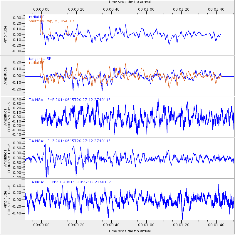
I48A Sherman Twp, MI, USA - Earthquake Result Viewer
*The percent match for this event was below the threshold and hence no stack was calculated.
| Earthquake location: |
Near East Coast Of Honshu, Japan |
| Earthquake latitude/longitude: |
37.1/141.1 |
| Earthquake time(UTC): |
2014/06/15 (166) 20:14:50 GMT |
| Earthquake Depth: |
40 km |
| Earthquake Magnitude: |
5.6 MB |
| Earthquake Catalog/Contributor: |
NEIC PDE/NEIC COMCAT |
|
| Network: |
TA USArray Transportable Network (new EarthScope stations) |
| Station: |
I48A Sherman Twp, MI, USA |
| Lat/Lon: |
44.19 N/83.70 W |
| Elevation: |
192 m |
|
| Distance: |
89.5 deg |
| Az: |
30.448 deg |
| Baz: |
325.728 deg |
| Ray Param: |
$rayparam |
*The percent match for this event was below the threshold and hence was not used in the summary stack. |
|
| Radial Match: |
60.72362 % |
| Radial Bump: |
400 |
| Transverse Match: |
52.592056 % |
| Transverse Bump: |
400 |
| SOD ConfigId: |
739768 |
| Insert Time: |
2014-06-29 21:01:19.561 +0000 |
| GWidth: |
2.5 |
| Max Bumps: |
400 |
| Tol: |
0.001 |
|
Signal To Noise
| Channel | StoN | STA | LTA |
| TA:I48A: :BHZ:20140615T20:27:12.274011Z | 4.001978 | 5.4479085E-7 | 1.3613041E-7 |
| TA:I48A: :BHN:20140615T20:27:12.274011Z | 1.9966586 | 1.9375636E-7 | 9.704031E-8 |
| TA:I48A: :BHE:20140615T20:27:12.274011Z | 1.4600339 | 1.7297977E-7 | 1.18476535E-7 |
| Arrivals |
| Ps | |
| PpPs | |
| PsPs/PpSs | |


