You are here: Home > Network List > TA - USArray Transportable Network (new EarthScope stations) Stations List
> Station J01E Myrtle Point, OR, USA > Earthquake Result Viewer
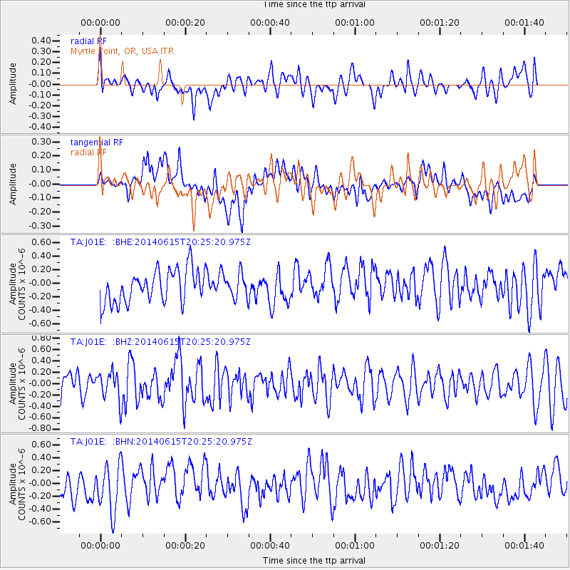
J01E Myrtle Point, OR, USA - Earthquake Result Viewer
*The percent match for this event was below the threshold and hence no stack was calculated.
| Earthquake location: |
Near East Coast Of Honshu, Japan |
| Earthquake latitude/longitude: |
37.1/141.1 |
| Earthquake time(UTC): |
2014/06/15 (166) 20:14:50 GMT |
| Earthquake Depth: |
40 km |
| Earthquake Magnitude: |
5.6 MB |
| Earthquake Catalog/Contributor: |
NEIC PDE/NEIC COMCAT |
|
| Network: |
TA USArray Transportable Network (new EarthScope stations) |
| Station: |
J01E Myrtle Point, OR, USA |
| Lat/Lon: |
43.16 N/123.93 W |
| Elevation: |
128 m |
|
| Distance: |
69.0 deg |
| Az: |
51.342 deg |
| Baz: |
301.447 deg |
| Ray Param: |
$rayparam |
*The percent match for this event was below the threshold and hence was not used in the summary stack. |
|
| Radial Match: |
43.851913 % |
| Radial Bump: |
400 |
| Transverse Match: |
43.27155 % |
| Transverse Bump: |
400 |
| SOD ConfigId: |
739768 |
| Insert Time: |
2014-06-29 21:01:52.431 +0000 |
| GWidth: |
2.5 |
| Max Bumps: |
400 |
| Tol: |
0.001 |
|
Signal To Noise
| Channel | StoN | STA | LTA |
| TA:J01E: :BHZ:20140615T20:25:20.975Z | 1.2962602 | 2.51471E-7 | 1.9399731E-7 |
| TA:J01E: :BHN:20140615T20:25:20.975Z | 1.7141054 | 3.9799045E-7 | 2.3218551E-7 |
| TA:J01E: :BHE:20140615T20:25:20.975Z | 0.72826606 | 1.773622E-7 | 2.4354037E-7 |
| Arrivals |
| Ps | |
| PpPs | |
| PsPs/PpSs | |


