PALK Pallekele, Sri Lanka - Earthquake Result Viewer
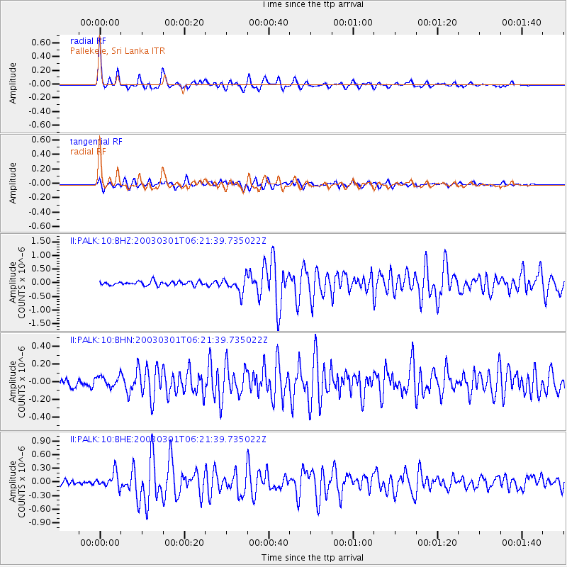
Earthquake location: Irian Jaya Region, Indonesia
Earthquake latitude/longitude: -1.7/134.3
Earthquake time(UTC): 2003/03/01 (060) 06:12:47 GMT
Earthquake Depth: 28 km
Earthquake Magnitude: 5.5 MB, 5.7 MS, 6.0 MW, 5.9 MW
Earthquake Catalog/Contributor: WHDF/NEIC
Network: II Global Seismograph Network (GSN - IRIS/IDA)
Station: PALK Pallekele, Sri Lanka
Lat/Lon: 7.27 N/80.70 E
Elevation: 460 m
Distance: 54.2 deg
Az: 280.154 deg
Baz: 97.35 deg
Ray Param: 0.065535896
Estimated Moho Depth: 40.25 km
Estimated Crust Vp/Vs: 1.66
Assumed Crust Vp: 6.545 km/s
Estimated Crust Vs: 3.937 km/s
Estimated Crust Poisson's Ratio: 0.22
Radial Match: 90.94397 %
Radial Bump: 336
Transverse Match: 79.27102 %
Transverse Bump: 400
SOD ConfigId: 4714
Insert Time: 2010-03-01 23:04:55.821 +0000
GWidth: 2.5
Max Bumps: 400
Tol: 0.001

Signal To Noise

ChannelStoNSTALTA
II:PALK:10:BHN:20030301T06:21:39.735022Z1.39630756.188224E-84.431849E-8
II:PALK:10:BHE:20030301T06:21:39.735022Z3.2263581.7397348E-75.392256E-8
II:PALK:10:BHZ:20030301T06:21:39.735022Z4.10916572.9148512E-77.093536E-8
Arrivals
Ps4.3 SECOND
PpPs15 SECOND
PsPs/PpSs20 SECOND