You are here: Home > Network List > TA - USArray Transportable Network (new EarthScope stations) Stations List
> Station O03E Paynes Creek, CA, USA > Earthquake Result Viewer
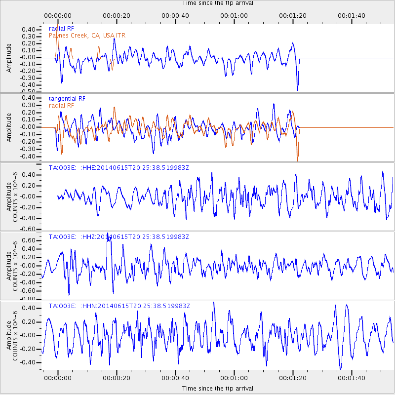
O03E Paynes Creek, CA, USA - Earthquake Result Viewer
*The percent match for this event was below the threshold and hence no stack was calculated.
| Earthquake location: |
Near East Coast Of Honshu, Japan |
| Earthquake latitude/longitude: |
37.1/141.1 |
| Earthquake time(UTC): |
2014/06/15 (166) 20:14:50 GMT |
| Earthquake Depth: |
40 km |
| Earthquake Magnitude: |
5.6 MB |
| Earthquake Catalog/Contributor: |
NEIC PDE/NEIC COMCAT |
|
| Network: |
TA USArray Transportable Network (new EarthScope stations) |
| Station: |
O03E Paynes Creek, CA, USA |
| Lat/Lon: |
40.29 N/121.80 W |
| Elevation: |
967 m |
|
| Distance: |
71.9 deg |
| Az: |
53.0 deg |
| Baz: |
303.416 deg |
| Ray Param: |
$rayparam |
*The percent match for this event was below the threshold and hence was not used in the summary stack. |
|
| Radial Match: |
56.213844 % |
| Radial Bump: |
400 |
| Transverse Match: |
65.091095 % |
| Transverse Bump: |
400 |
| SOD ConfigId: |
739768 |
| Insert Time: |
2014-06-29 21:04:08.664 +0000 |
| GWidth: |
2.5 |
| Max Bumps: |
400 |
| Tol: |
0.001 |
|
Signal To Noise
| Channel | StoN | STA | LTA |
| TA:O03E: :HHZ:20140615T20:25:38.519983Z | 3.3880198 | 2.7406085E-7 | 8.089116E-8 |
| TA:O03E: :HHN:20140615T20:25:38.519983Z | 1.5503783 | 1.9770499E-7 | 1.2752048E-7 |
| TA:O03E: :HHE:20140615T20:25:38.519983Z | 0.8282187 | 9.7839795E-8 | 1.18132796E-7 |
| Arrivals |
| Ps | |
| PpPs | |
| PsPs/PpSs | |


