You are here: Home > Network List > TA - USArray Transportable Network (new EarthScope stations) Stations List
> Station O48A Farmland, IN, USA > Earthquake Result Viewer
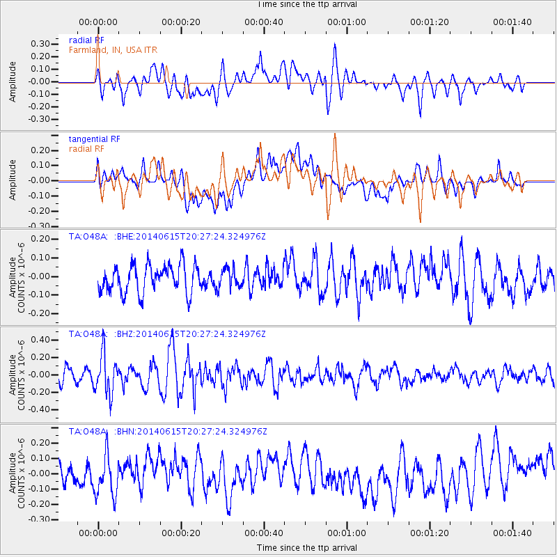
O48A Farmland, IN, USA - Earthquake Result Viewer
*The percent match for this event was below the threshold and hence no stack was calculated.
| Earthquake location: |
Near East Coast Of Honshu, Japan |
| Earthquake latitude/longitude: |
37.1/141.1 |
| Earthquake time(UTC): |
2014/06/15 (166) 20:14:50 GMT |
| Earthquake Depth: |
40 km |
| Earthquake Magnitude: |
5.6 MB |
| Earthquake Catalog/Contributor: |
NEIC PDE/NEIC COMCAT |
|
| Network: |
TA USArray Transportable Network (new EarthScope stations) |
| Station: |
O48A Farmland, IN, USA |
| Lat/Lon: |
40.26 N/85.16 W |
| Elevation: |
300 m |
|
| Distance: |
92.1 deg |
| Az: |
33.575 deg |
| Baz: |
324.712 deg |
| Ray Param: |
$rayparam |
*The percent match for this event was below the threshold and hence was not used in the summary stack. |
|
| Radial Match: |
52.34677 % |
| Radial Bump: |
400 |
| Transverse Match: |
39.23387 % |
| Transverse Bump: |
400 |
| SOD ConfigId: |
739768 |
| Insert Time: |
2014-06-29 21:04:09.292 +0000 |
| GWidth: |
2.5 |
| Max Bumps: |
400 |
| Tol: |
0.001 |
|
Signal To Noise
| Channel | StoN | STA | LTA |
| TA:O48A: :BHZ:20140615T20:27:24.324976Z | 3.0873935 | 2.3115342E-7 | 7.487009E-8 |
| TA:O48A: :BHN:20140615T20:27:24.324976Z | 1.1349028 | 1.3085632E-7 | 1.1530179E-7 |
| TA:O48A: :BHE:20140615T20:27:24.324976Z | 0.6600944 | 4.9361404E-8 | 7.477931E-8 |
| Arrivals |
| Ps | |
| PpPs | |
| PsPs/PpSs | |


