You are here: Home > Network List > TA - USArray Transportable Network (new EarthScope stations) Stations List
> Station 833A Chaparral WMA, Artesia Wells, TX, USA > Earthquake Result Viewer
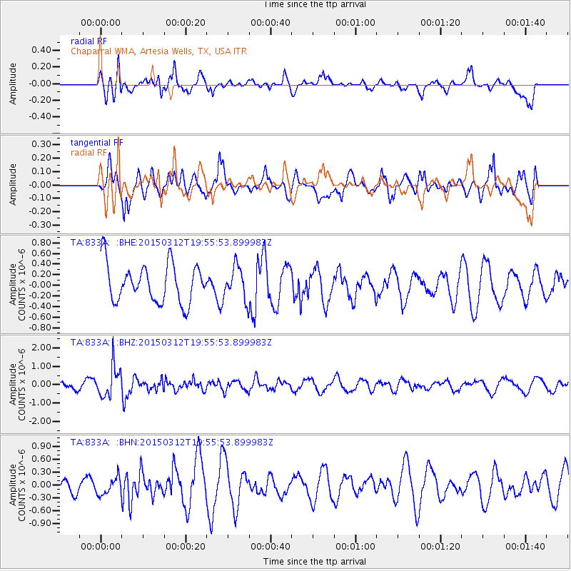
833A Chaparral WMA, Artesia Wells, TX, USA - Earthquake Result Viewer
*The percent match for this event was below the threshold and hence no stack was calculated.
| Earthquake location: |
South Of Alaska |
| Earthquake latitude/longitude: |
52.9/-162.9 |
| Earthquake time(UTC): |
2015/03/12 (071) 19:47:14 GMT |
| Earthquake Depth: |
12 km |
| Earthquake Magnitude: |
5.2 MW |
| Earthquake Catalog/Contributor: |
ISC/ISC |
|
| Network: |
TA USArray Transportable Network (new EarthScope stations) |
| Station: |
833A Chaparral WMA, Artesia Wells, TX, USA |
| Lat/Lon: |
28.32 N/99.39 W |
| Elevation: |
171 m |
|
| Distance: |
52.1 deg |
| Az: |
91.918 deg |
| Baz: |
316.588 deg |
| Ray Param: |
$rayparam |
*The percent match for this event was below the threshold and hence was not used in the summary stack. |
|
| Radial Match: |
53.435474 % |
| Radial Bump: |
400 |
| Transverse Match: |
70.69619 % |
| Transverse Bump: |
400 |
| SOD ConfigId: |
7019011 |
| Insert Time: |
2019-04-17 08:04:28.458 +0000 |
| GWidth: |
2.5 |
| Max Bumps: |
400 |
| Tol: |
0.001 |
|
Signal To Noise
| Channel | StoN | STA | LTA |
| TA:833A: :BHZ:20150312T19:55:53.899983Z | 2.5285892 | 8.589003E-7 | 3.396757E-7 |
| TA:833A: :BHN:20150312T19:55:53.899983Z | 0.65151006 | 2.0615904E-7 | 3.1643265E-7 |
| TA:833A: :BHE:20150312T19:55:53.899983Z | 0.8611854 | 3.1202345E-7 | 3.6231856E-7 |
| Arrivals |
| Ps | |
| PpPs | |
| PsPs/PpSs | |


