
PALK Pallekele, Sri Lanka - Earthquake Result Viewer
| ||||||||||||||||||
| ||||||||||||||||||
| ||||||||||||||||||
|
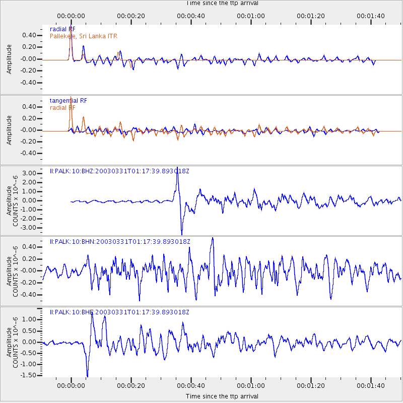
Signal To Noise
| Channel | StoN | STA | LTA |
| II:PALK:10:BHN:20030331T01:17:39.893018Z | 1.3721441 | 6.218882E-8 | 4.5322366E-8 |
| II:PALK:10:BHE:20030331T01:17:39.893018Z | 3.0392787 | 1.4001238E-7 | 4.606763E-8 |
| II:PALK:10:BHZ:20030331T01:17:39.893018Z | 4.576726 | 3.5051457E-7 | 7.658632E-8 |
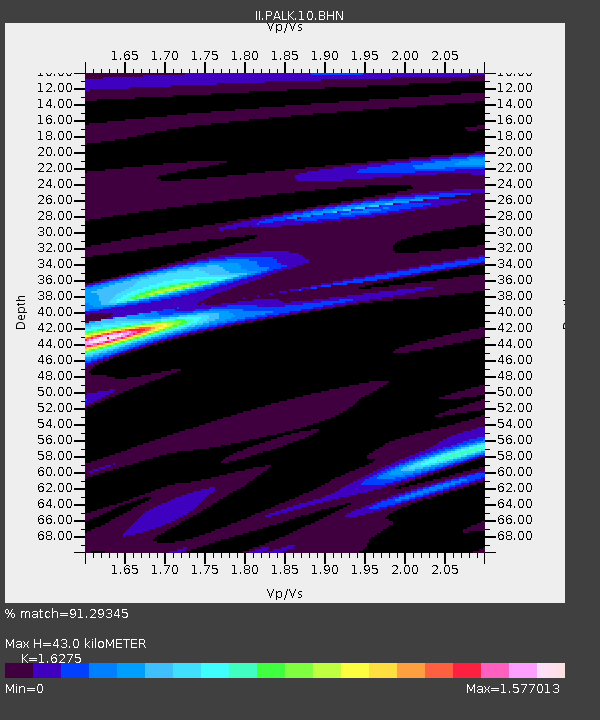
| Arrivals | |
| Ps | 4.3 SECOND |
| PpPs | 17 SECOND |
| PsPs/PpSs | 21 SECOND |

