You are here: Home > Network List > UW - Pacific Northwest Regional Seismic Network Stations List
> Station MRBL Marblemount, WA, USA > Earthquake Result Viewer
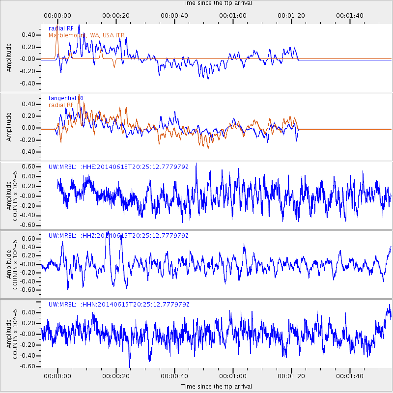
MRBL Marblemount, WA, USA - Earthquake Result Viewer
*The percent match for this event was below the threshold and hence no stack was calculated.
| Earthquake location: |
Near East Coast Of Honshu, Japan |
| Earthquake latitude/longitude: |
37.1/141.1 |
| Earthquake time(UTC): |
2014/06/15 (166) 20:14:50 GMT |
| Earthquake Depth: |
40 km |
| Earthquake Magnitude: |
5.6 MB |
| Earthquake Catalog/Contributor: |
NEIC PDE/NEIC COMCAT |
|
| Network: |
UW Pacific Northwest Regional Seismic Network |
| Station: |
MRBL Marblemount, WA, USA |
| Lat/Lon: |
48.52 N/121.48 W |
| Elevation: |
75 m |
|
| Distance: |
67.7 deg |
| Az: |
45.458 deg |
| Baz: |
301.024 deg |
| Ray Param: |
$rayparam |
*The percent match for this event was below the threshold and hence was not used in the summary stack. |
|
| Radial Match: |
40.53318 % |
| Radial Bump: |
400 |
| Transverse Match: |
46.743763 % |
| Transverse Bump: |
400 |
| SOD ConfigId: |
739768 |
| Insert Time: |
2014-06-29 21:12:04.478 +0000 |
| GWidth: |
2.5 |
| Max Bumps: |
400 |
| Tol: |
0.001 |
|
Signal To Noise
| Channel | StoN | STA | LTA |
| UW:MRBL: :HHZ:20140615T20:25:12.777979Z | 2.4060812 | 2.4105293E-7 | 1.0018486E-7 |
| UW:MRBL: :HHN:20140615T20:25:12.777979Z | 0.7862858 | 1.2353043E-7 | 1.5710626E-7 |
| UW:MRBL: :HHE:20140615T20:25:12.777979Z | 1.7367511 | 2.6166896E-7 | 1.5066578E-7 |
| Arrivals |
| Ps | |
| PpPs | |
| PsPs/PpSs | |


