You are here: Home > Network List > G - GEOSCOPE Stations List
> Station MPG Montagne des Peres, French Guyana > Earthquake Result Viewer
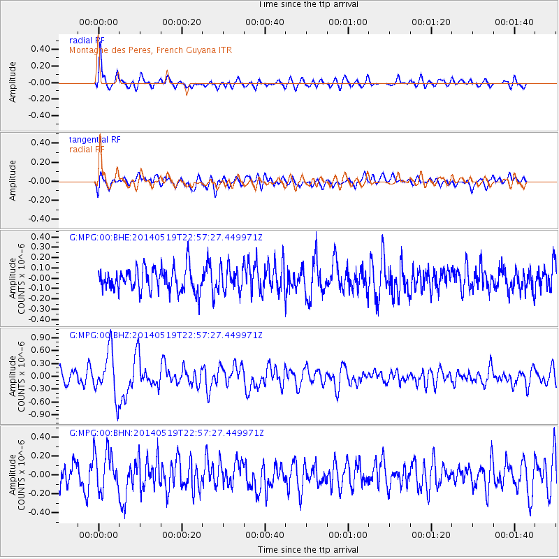
MPG Montagne des Peres, French Guyana - Earthquake Result Viewer
*The percent match for this event was below the threshold and hence no stack was calculated.
| Earthquake location: |
South Sandwich Islands Region |
| Earthquake latitude/longitude: |
-57.0/-25.1 |
| Earthquake time(UTC): |
2014/05/19 (139) 22:47:12 GMT |
| Earthquake Depth: |
10 km |
| Earthquake Magnitude: |
5.7 MWW, 5.7 MWC |
| Earthquake Catalog/Contributor: |
NEIC PDE/NEIC COMCAT |
|
| Network: |
G GEOSCOPE |
| Station: |
MPG Montagne des Peres, French Guyana |
| Lat/Lon: |
5.11 N/52.64 W |
| Elevation: |
147 m |
|
| Distance: |
65.9 deg |
| Az: |
329.739 deg |
| Baz: |
163.943 deg |
| Ray Param: |
$rayparam |
*The percent match for this event was below the threshold and hence was not used in the summary stack. |
|
| Radial Match: |
59.968796 % |
| Radial Bump: |
400 |
| Transverse Match: |
48.560417 % |
| Transverse Bump: |
400 |
| SOD ConfigId: |
739768 |
| Insert Time: |
2014-06-30 02:36:18.133 +0000 |
| GWidth: |
2.5 |
| Max Bumps: |
400 |
| Tol: |
0.001 |
|
Signal To Noise
| Channel | StoN | STA | LTA |
| G:MPG:00:BHZ:20140519T22:57:27.449971Z | 3.3415716 | 5.4825966E-7 | 1.640724E-7 |
| G:MPG:00:BHN:20140519T22:57:27.449971Z | 1.4229579 | 2.0289878E-7 | 1.4258946E-7 |
| G:MPG:00:BHE:20140519T22:57:27.449971Z | 1.0034481 | 1.12360745E-7 | 1.1197465E-7 |
| Arrivals |
| Ps | |
| PpPs | |
| PsPs/PpSs | |


