
PALK Pallekele, Sri Lanka - Earthquake Result Viewer
| ||||||||||||||||||
| ||||||||||||||||||
| ||||||||||||||||||
|
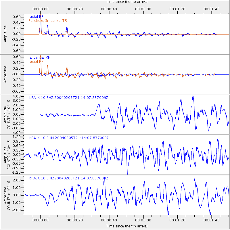
Signal To Noise
| Channel | StoN | STA | LTA |
| II:PALK:10:BHN:20040205T21:14:07.837009Z | 3.6287758 | 2.2685587E-7 | 6.251582E-8 |
| II:PALK:10:BHE:20040205T21:14:07.837009Z | 4.9398556 | 6.218279E-7 | 1.2587977E-7 |
| II:PALK:10:BHZ:20040205T21:14:07.837009Z | 8.464474 | 1.219075E-6 | 1.4402255E-7 |
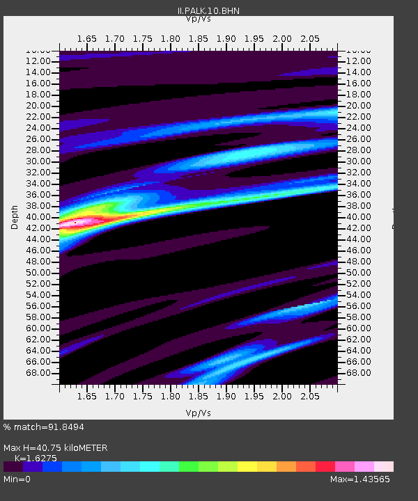
| Arrivals | |
| Ps | 4.1 SECOND |
| PpPs | 15 SECOND |
| PsPs/PpSs | 20 SECOND |

