You are here: Home > Network List > NE - New England Seismic Network Stations List
> Station EMMW Machias, ME, USA > Earthquake Result Viewer
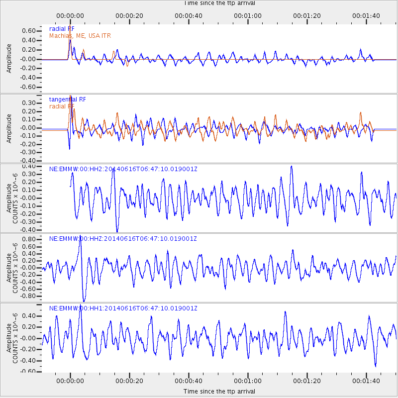
EMMW Machias, ME, USA - Earthquake Result Viewer
*The percent match for this event was below the threshold and hence no stack was calculated.
| Earthquake location: |
Near Coast Of Ecuador |
| Earthquake latitude/longitude: |
1.6/-79.2 |
| Earthquake time(UTC): |
2014/06/16 (167) 06:39:31 GMT |
| Earthquake Depth: |
10 km |
| Earthquake Magnitude: |
5.7 MWP, 5.6 MWB |
| Earthquake Catalog/Contributor: |
NEIC PDE/NEIC COMCAT |
|
| Network: |
NE New England Seismic Network |
| Station: |
EMMW Machias, ME, USA |
| Lat/Lon: |
44.71 N/67.46 W |
| Elevation: |
35 m |
|
| Distance: |
44.2 deg |
| Az: |
12.049 deg |
| Baz: |
197.015 deg |
| Ray Param: |
$rayparam |
*The percent match for this event was below the threshold and hence was not used in the summary stack. |
|
| Radial Match: |
64.25341 % |
| Radial Bump: |
400 |
| Transverse Match: |
59.63124 % |
| Transverse Bump: |
400 |
| SOD ConfigId: |
739768 |
| Insert Time: |
2014-06-30 06:59:27.747 +0000 |
| GWidth: |
2.5 |
| Max Bumps: |
400 |
| Tol: |
0.001 |
|
Signal To Noise
| Channel | StoN | STA | LTA |
| NE:EMMW:00:HHZ:20140616T06:47:10.019001Z | 2.5014431 | 4.6398657E-7 | 1.8548755E-7 |
| NE:EMMW:00:HH1:20140616T06:47:10.019001Z | 1.4493747 | 2.7272372E-7 | 1.8816647E-7 |
| NE:EMMW:00:HH2:20140616T06:47:10.019001Z | 0.92105484 | 1.4673472E-7 | 1.5931161E-7 |
| Arrivals |
| Ps | |
| PpPs | |
| PsPs/PpSs | |


