You are here: Home > Network List > TA - USArray Transportable Network (new EarthScope stations) Stations List
> Station J47A Sunmer, MI, USA > Earthquake Result Viewer
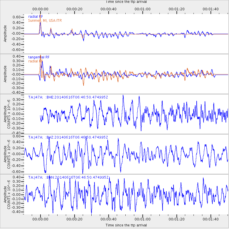
J47A Sunmer, MI, USA - Earthquake Result Viewer
*The percent match for this event was below the threshold and hence no stack was calculated.
| Earthquake location: |
Near Coast Of Ecuador |
| Earthquake latitude/longitude: |
1.6/-79.2 |
| Earthquake time(UTC): |
2014/06/16 (167) 06:39:31 GMT |
| Earthquake Depth: |
10 km |
| Earthquake Magnitude: |
5.7 MWP, 5.6 MWB |
| Earthquake Catalog/Contributor: |
NEIC PDE/NEIC COMCAT |
|
| Network: |
TA USArray Transportable Network (new EarthScope stations) |
| Station: |
J47A Sunmer, MI, USA |
| Lat/Lon: |
43.24 N/84.82 W |
| Elevation: |
236 m |
|
| Distance: |
41.8 deg |
| Az: |
353.863 deg |
| Baz: |
171.591 deg |
| Ray Param: |
$rayparam |
*The percent match for this event was below the threshold and hence was not used in the summary stack. |
|
| Radial Match: |
60.09262 % |
| Radial Bump: |
400 |
| Transverse Match: |
61.702835 % |
| Transverse Bump: |
400 |
| SOD ConfigId: |
739768 |
| Insert Time: |
2014-06-30 07:08:35.566 +0000 |
| GWidth: |
2.5 |
| Max Bumps: |
400 |
| Tol: |
0.001 |
|
Signal To Noise
| Channel | StoN | STA | LTA |
| TA:J47A: :BHZ:20140616T06:46:50.474995Z | 3.5660486 | 3.143201E-7 | 8.814239E-8 |
| TA:J47A: :BHN:20140616T06:46:50.474995Z | 1.3382978 | 1.3044128E-7 | 9.746805E-8 |
| TA:J47A: :BHE:20140616T06:46:50.474995Z | 1.9003967 | 1.7929914E-7 | 9.4348266E-8 |
| Arrivals |
| Ps | |
| PpPs | |
| PsPs/PpSs | |


