You are here: Home > Network List > US - United States National Seismic Network Stations List
> Station DGMT Dagmar, Montana, USA > Earthquake Result Viewer
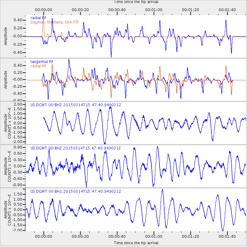
DGMT Dagmar, Montana, USA - Earthquake Result Viewer
*The percent match for this event was below the threshold and hence no stack was calculated.
| Earthquake location: |
Off East Coast Of Honshu, Japan |
| Earthquake latitude/longitude: |
34.3/141.6 |
| Earthquake time(UTC): |
2015/03/14 (073) 15:36:10 GMT |
| Earthquake Depth: |
17 km |
| Earthquake Magnitude: |
5.0 MW |
| Earthquake Catalog/Contributor: |
ISC/ISC |
|
| Network: |
US United States National Seismic Network |
| Station: |
DGMT Dagmar, Montana, USA |
| Lat/Lon: |
48.47 N/104.20 W |
| Elevation: |
0.0 m |
|
| Distance: |
78.9 deg |
| Az: |
38.215 deg |
| Baz: |
309.697 deg |
| Ray Param: |
$rayparam |
*The percent match for this event was below the threshold and hence was not used in the summary stack. |
|
| Radial Match: |
38.746784 % |
| Radial Bump: |
277 |
| Transverse Match: |
48.0413 % |
| Transverse Bump: |
271 |
| SOD ConfigId: |
7019011 |
| Insert Time: |
2019-04-17 08:20:37.188 +0000 |
| GWidth: |
2.5 |
| Max Bumps: |
400 |
| Tol: |
0.001 |
|
Signal To Noise
| Channel | StoN | STA | LTA |
| US:DGMT:00:BHZ:20150314T15:47:40.949021Z | 1.217843 | 3.194915E-7 | 2.623421E-7 |
| US:DGMT:00:BH1:20150314T15:47:40.949021Z | 0.9389218 | 6.989423E-7 | 7.444095E-7 |
| US:DGMT:00:BH2:20150314T15:47:40.949021Z | 1.7508692 | 1.2991375E-6 | 7.4199573E-7 |
| Arrivals |
| Ps | |
| PpPs | |
| PsPs/PpSs | |


