You are here: Home > Network List > TA - USArray Transportable Network (new EarthScope stations) Stations List
> Station P59A Jarrettsville, MD, USA > Earthquake Result Viewer
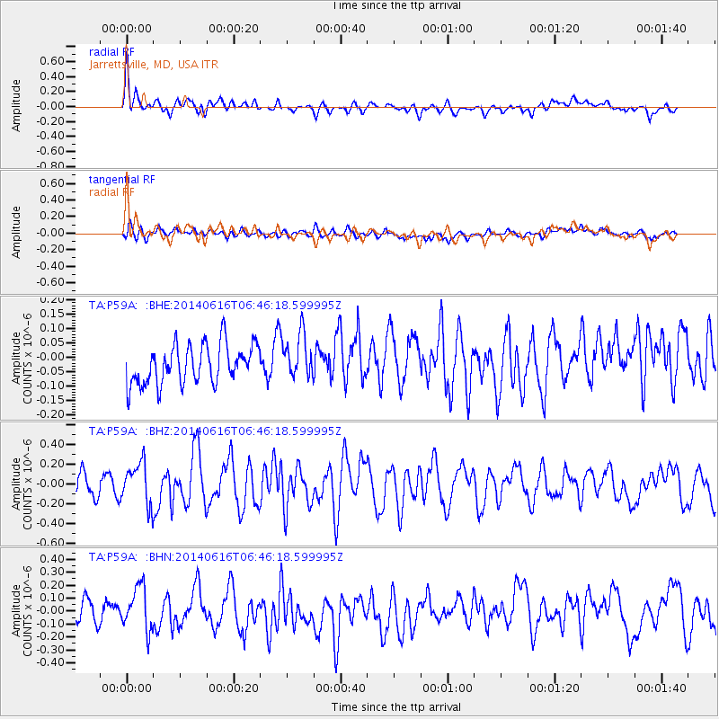
P59A Jarrettsville, MD, USA - Earthquake Result Viewer
*The percent match for this event was below the threshold and hence no stack was calculated.
| Earthquake location: |
Near Coast Of Ecuador |
| Earthquake latitude/longitude: |
1.6/-79.2 |
| Earthquake time(UTC): |
2014/06/16 (167) 06:39:31 GMT |
| Earthquake Depth: |
10 km |
| Earthquake Magnitude: |
5.7 MWP, 5.6 MWB |
| Earthquake Catalog/Contributor: |
NEIC PDE/NEIC COMCAT |
|
| Network: |
TA USArray Transportable Network (new EarthScope stations) |
| Station: |
P59A Jarrettsville, MD, USA |
| Lat/Lon: |
39.61 N/76.43 W |
| Elevation: |
157 m |
|
| Distance: |
37.9 deg |
| Az: |
3.516 deg |
| Baz: |
184.551 deg |
| Ray Param: |
$rayparam |
*The percent match for this event was below the threshold and hence was not used in the summary stack. |
|
| Radial Match: |
73.23756 % |
| Radial Bump: |
400 |
| Transverse Match: |
57.695007 % |
| Transverse Bump: |
400 |
| SOD ConfigId: |
739768 |
| Insert Time: |
2014-06-30 07:13:53.890 +0000 |
| GWidth: |
2.5 |
| Max Bumps: |
400 |
| Tol: |
0.001 |
|
Signal To Noise
| Channel | StoN | STA | LTA |
| TA:P59A: :BHZ:20140616T06:46:18.599995Z | 2.0813193 | 2.121635E-7 | 1.01937026E-7 |
| TA:P59A: :BHN:20140616T06:46:18.599995Z | 2.1261477 | 1.7660282E-7 | 8.3062346E-8 |
| TA:P59A: :BHE:20140616T06:46:18.599995Z | 1.1553082 | 7.795076E-8 | 6.7471824E-8 |
| Arrivals |
| Ps | |
| PpPs | |
| PsPs/PpSs | |


