You are here: Home > Network List > TA - USArray Transportable Network (new EarthScope stations) Stations List
> Station T57A Hurt, VA, USA > Earthquake Result Viewer
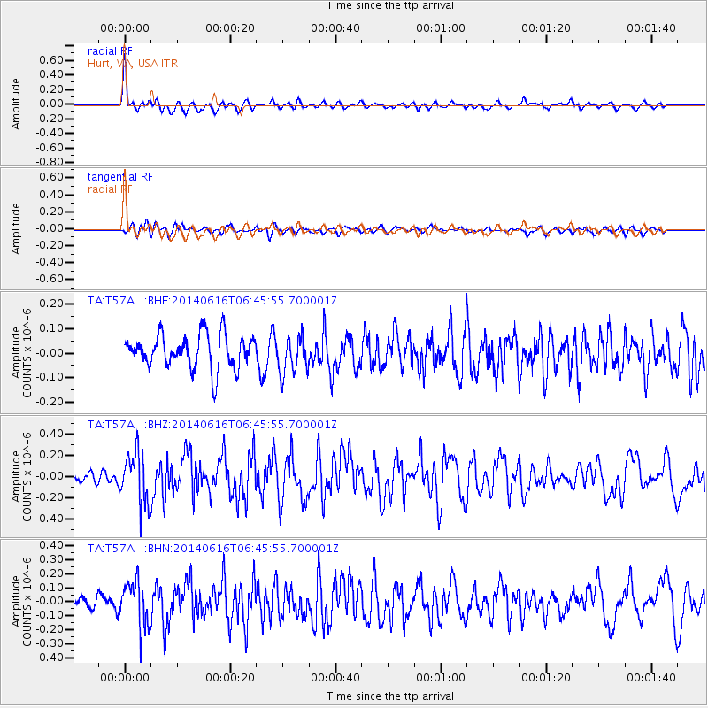
T57A Hurt, VA, USA - Earthquake Result Viewer
*The percent match for this event was below the threshold and hence no stack was calculated.
| Earthquake location: |
Near Coast Of Ecuador |
| Earthquake latitude/longitude: |
1.6/-79.2 |
| Earthquake time(UTC): |
2014/06/16 (167) 06:39:31 GMT |
| Earthquake Depth: |
10 km |
| Earthquake Magnitude: |
5.7 MWP, 5.6 MWB |
| Earthquake Catalog/Contributor: |
NEIC PDE/NEIC COMCAT |
|
| Network: |
TA USArray Transportable Network (new EarthScope stations) |
| Station: |
T57A Hurt, VA, USA |
| Lat/Lon: |
37.00 N/79.25 W |
| Elevation: |
230 m |
|
| Distance: |
35.2 deg |
| Az: |
359.966 deg |
| Baz: |
179.958 deg |
| Ray Param: |
$rayparam |
*The percent match for this event was below the threshold and hence was not used in the summary stack. |
|
| Radial Match: |
73.01941 % |
| Radial Bump: |
365 |
| Transverse Match: |
52.765594 % |
| Transverse Bump: |
400 |
| SOD ConfigId: |
739768 |
| Insert Time: |
2014-06-30 07:16:02.563 +0000 |
| GWidth: |
2.5 |
| Max Bumps: |
400 |
| Tol: |
0.001 |
|
Signal To Noise
| Channel | StoN | STA | LTA |
| TA:T57A: :BHZ:20140616T06:45:55.700001Z | 5.4376826 | 2.3934274E-7 | 4.401558E-8 |
| TA:T57A: :BHN:20140616T06:45:55.700001Z | 3.1727953 | 1.6211368E-7 | 5.1094904E-8 |
| TA:T57A: :BHE:20140616T06:45:55.700001Z | 1.114738 | 7.6381774E-8 | 6.851994E-8 |
| Arrivals |
| Ps | |
| PpPs | |
| PsPs/PpSs | |


