You are here: Home > Network List > TA - USArray Transportable Network (new EarthScope stations) Stations List
> Station O48A Farmland, IN, USA > Earthquake Result Viewer
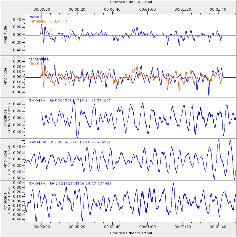
O48A Farmland, IN, USA - Earthquake Result Viewer
*The percent match for this event was below the threshold and hence no stack was calculated.
| Earthquake location: |
Near Coast Of Northern Chile |
| Earthquake latitude/longitude: |
-27.8/-71.0 |
| Earthquake time(UTC): |
2015/03/14 (073) 16:03:46 GMT |
| Earthquake Depth: |
33 km |
| Earthquake Magnitude: |
5.1 mb |
| Earthquake Catalog/Contributor: |
ISC/ISC |
|
| Network: |
TA USArray Transportable Network (new EarthScope stations) |
| Station: |
O48A Farmland, IN, USA |
| Lat/Lon: |
40.26 N/85.16 W |
| Elevation: |
300 m |
|
| Distance: |
68.9 deg |
| Az: |
348.466 deg |
| Baz: |
166.614 deg |
| Ray Param: |
$rayparam |
*The percent match for this event was below the threshold and hence was not used in the summary stack. |
|
| Radial Match: |
41.465023 % |
| Radial Bump: |
400 |
| Transverse Match: |
52.531902 % |
| Transverse Bump: |
400 |
| SOD ConfigId: |
7422571 |
| Insert Time: |
2019-04-17 18:35:50.763 +0000 |
| GWidth: |
2.5 |
| Max Bumps: |
400 |
| Tol: |
0.001 |
|
Signal To Noise
| Channel | StoN | STA | LTA |
| TA:O48A: :BHZ:20150314T16:14:17.57499Z | 1.2869065 | 1.2668336E-7 | 9.844022E-8 |
| TA:O48A: :BHN:20150314T16:14:17.57499Z | 1.4792972 | 1.8471117E-7 | 1.2486414E-7 |
| TA:O48A: :BHE:20150314T16:14:17.57499Z | 1.1272788 | 2.3119807E-7 | 2.0509395E-7 |
| Arrivals |
| Ps | |
| PpPs | |
| PsPs/PpSs | |


