WRAB Tennant Creek, NT, Australia - Earthquake Result Viewer
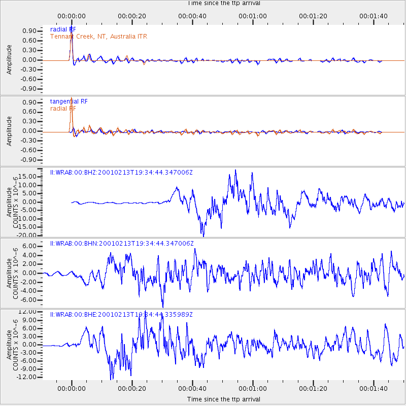
Earthquake location: Southern Sumatra, Indonesia
Earthquake latitude/longitude: -4.7/102.6
Earthquake time(UTC): 2001/02/13 (044) 19:28:30 GMT
Earthquake Depth: 36 km
Earthquake Magnitude: 6.2 MB, 7.2 MS, 7.4 MW, 7.0 ME
Earthquake Catalog/Contributor: WHDF/NEIC
Network: II Global Seismograph Network (GSN - IRIS/IDA)
Station: WRAB Tennant Creek, NT, Australia
Lat/Lon: 19.93 S/134.36 E
Elevation: 366 m
Distance: 34.5 deg
Az: 118.84 deg
Baz: 291.874 deg
Ray Param: 0.07765798
Estimated Moho Depth: 54.5 km
Estimated Crust Vp/Vs: 1.67
Assumed Crust Vp: 6.642 km/s
Estimated Crust Vs: 3.971 km/s
Estimated Crust Poisson's Ratio: 0.22
Radial Match: 96.464584 %
Radial Bump: 360
Transverse Match: 82.432976 %
Transverse Bump: 400
SOD ConfigId: 3744
Insert Time: 2010-03-01 23:07:08.847 +0000
GWidth: 2.5
Max Bumps: 400
Tol: 0.001

Signal To Noise

ChannelStoNSTALTA
II:WRAB:00:BHN:20010213T19:34:44.347006Z3.65480231.0565641E-62.8908926E-7
II:WRAB:00:BHE:20010213T19:34:44.335989Z10.2485482.6346097E-62.5707152E-7
II:WRAB:00:BHZ:20010213T19:34:44.347006Z11.0185653.7528346E-63.4059192E-7
Arrivals
Ps6.0 SECOND
PpPs20 SECOND
PsPs/PpSs26 SECOND