You are here: Home > Network List > GS - US Geological Survey Networks Stations List
> Station KAN10 Keim Farm > Earthquake Result Viewer
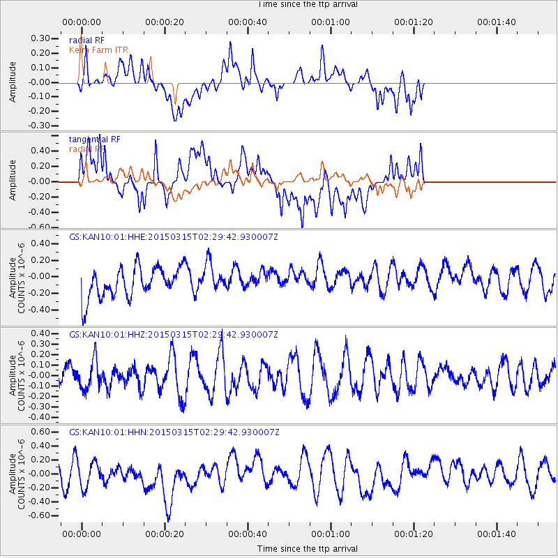
KAN10 Keim Farm - Earthquake Result Viewer
*The percent match for this event was below the threshold and hence no stack was calculated.
| Earthquake location: |
South Of Fiji Islands |
| Earthquake latitude/longitude: |
-22.3/-176.3 |
| Earthquake time(UTC): |
2015/03/15 (074) 02:17:04 GMT |
| Earthquake Depth: |
86 km |
| Earthquake Magnitude: |
5.5 MW |
| Earthquake Catalog/Contributor: |
ISC/ISC |
|
| Network: |
GS US Geological Survey Networks |
| Station: |
KAN10 Keim Farm |
| Lat/Lon: |
37.12 N/98.10 W |
| Elevation: |
417 m |
|
| Distance: |
94.3 deg |
| Az: |
51.671 deg |
| Baz: |
245.383 deg |
| Ray Param: |
$rayparam |
*The percent match for this event was below the threshold and hence was not used in the summary stack. |
|
| Radial Match: |
35.762447 % |
| Radial Bump: |
400 |
| Transverse Match: |
52.027237 % |
| Transverse Bump: |
400 |
| SOD ConfigId: |
7422571 |
| Insert Time: |
2019-04-17 18:43:35.162 +0000 |
| GWidth: |
2.5 |
| Max Bumps: |
400 |
| Tol: |
0.001 |
|
Signal To Noise
| Channel | StoN | STA | LTA |
| GS:KAN10:01:HHZ:20150315T02:29:42.930007Z | 0.92981285 | 1.4053524E-7 | 1.5114358E-7 |
| GS:KAN10:01:HHN:20150315T02:29:42.930007Z | 0.797172 | 2.712277E-7 | 3.4023736E-7 |
| GS:KAN10:01:HHE:20150315T02:29:42.930007Z | 0.9706231 | 1.764929E-7 | 1.8183465E-7 |
| Arrivals |
| Ps | |
| PpPs | |
| PsPs/PpSs | |


