You are here: Home > Network List > TA - USArray Transportable Network (new EarthScope stations) Stations List
> Station G05D Wamic, OR, USA > Earthquake Result Viewer
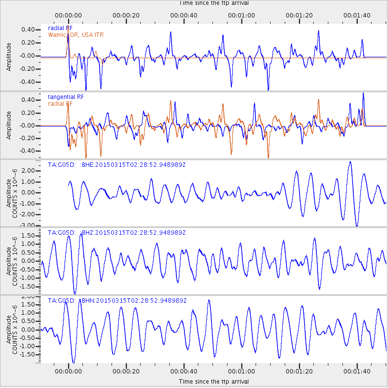
G05D Wamic, OR, USA - Earthquake Result Viewer
*The percent match for this event was below the threshold and hence no stack was calculated.
| Earthquake location: |
South Of Fiji Islands |
| Earthquake latitude/longitude: |
-22.3/-176.3 |
| Earthquake time(UTC): |
2015/03/15 (074) 02:17:04 GMT |
| Earthquake Depth: |
86 km |
| Earthquake Magnitude: |
5.5 MW |
| Earthquake Catalog/Contributor: |
ISC/ISC |
|
| Network: |
TA USArray Transportable Network (new EarthScope stations) |
| Station: |
G05D Wamic, OR, USA |
| Lat/Lon: |
45.24 N/121.32 W |
| Elevation: |
592 m |
|
| Distance: |
83.7 deg |
| Az: |
35.575 deg |
| Baz: |
229.709 deg |
| Ray Param: |
$rayparam |
*The percent match for this event was below the threshold and hence was not used in the summary stack. |
|
| Radial Match: |
70.858734 % |
| Radial Bump: |
364 |
| Transverse Match: |
70.111664 % |
| Transverse Bump: |
376 |
| SOD ConfigId: |
7422571 |
| Insert Time: |
2019-04-17 18:45:12.715 +0000 |
| GWidth: |
2.5 |
| Max Bumps: |
400 |
| Tol: |
0.001 |
|
Signal To Noise
| Channel | StoN | STA | LTA |
| TA:G05D: :BHZ:20150315T02:28:52.948989Z | 2.0510712 | 1.2738512E-6 | 6.210663E-7 |
| TA:G05D: :BHN:20150315T02:28:52.948989Z | 3.6290421 | 1.3607605E-6 | 3.7496412E-7 |
| TA:G05D: :BHE:20150315T02:28:52.948989Z | 1.0985633 | 6.6676483E-7 | 6.0694254E-7 |
| Arrivals |
| Ps | |
| PpPs | |
| PsPs/PpSs | |


