You are here: Home > Network List > US - United States National Seismic Network Stations List
> Station MSO Missoula, Montana, USA > Earthquake Result Viewer
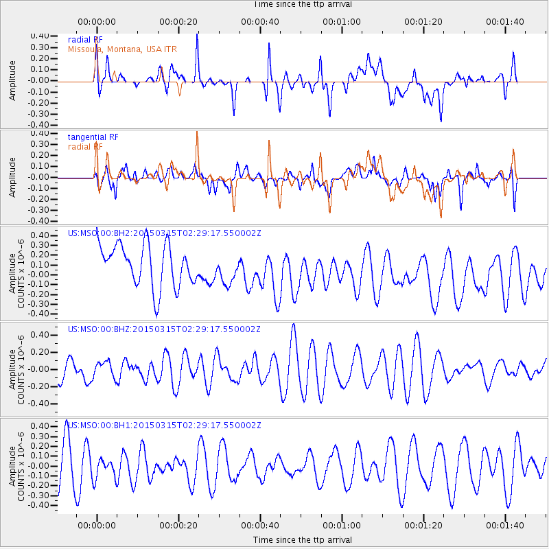
MSO Missoula, Montana, USA - Earthquake Result Viewer
*The percent match for this event was below the threshold and hence no stack was calculated.
| Earthquake location: |
South Of Fiji Islands |
| Earthquake latitude/longitude: |
-22.3/-176.3 |
| Earthquake time(UTC): |
2015/03/15 (074) 02:17:04 GMT |
| Earthquake Depth: |
86 km |
| Earthquake Magnitude: |
5.5 MW |
| Earthquake Catalog/Contributor: |
ISC/ISC |
|
| Network: |
US United States National Seismic Network |
| Station: |
MSO Missoula, Montana, USA |
| Lat/Lon: |
46.83 N/113.94 W |
| Elevation: |
1264 m |
|
| Distance: |
88.8 deg |
| Az: |
37.456 deg |
| Baz: |
235.128 deg |
| Ray Param: |
$rayparam |
*The percent match for this event was below the threshold and hence was not used in the summary stack. |
|
| Radial Match: |
38.417313 % |
| Radial Bump: |
400 |
| Transverse Match: |
28.991793 % |
| Transverse Bump: |
389 |
| SOD ConfigId: |
7422571 |
| Insert Time: |
2019-04-17 18:45:52.033 +0000 |
| GWidth: |
2.5 |
| Max Bumps: |
400 |
| Tol: |
0.001 |
|
Signal To Noise
| Channel | StoN | STA | LTA |
| US:MSO:00:BHZ:20150315T02:29:17.550002Z | 0.59159577 | 9.059235E-8 | 1.5313218E-7 |
| US:MSO:00:BH1:20150315T02:29:17.550002Z | 0.5867315 | 1.1286826E-7 | 1.923678E-7 |
| US:MSO:00:BH2:20150315T02:29:17.550002Z | 0.7128723 | 1.5059786E-7 | 2.1125501E-7 |
| Arrivals |
| Ps | |
| PpPs | |
| PsPs/PpSs | |


