You are here: Home > Network List > TA - USArray Transportable Network (new EarthScope stations) Stations List
> Station I64A Boothbay, ME, USA > Earthquake Result Viewer
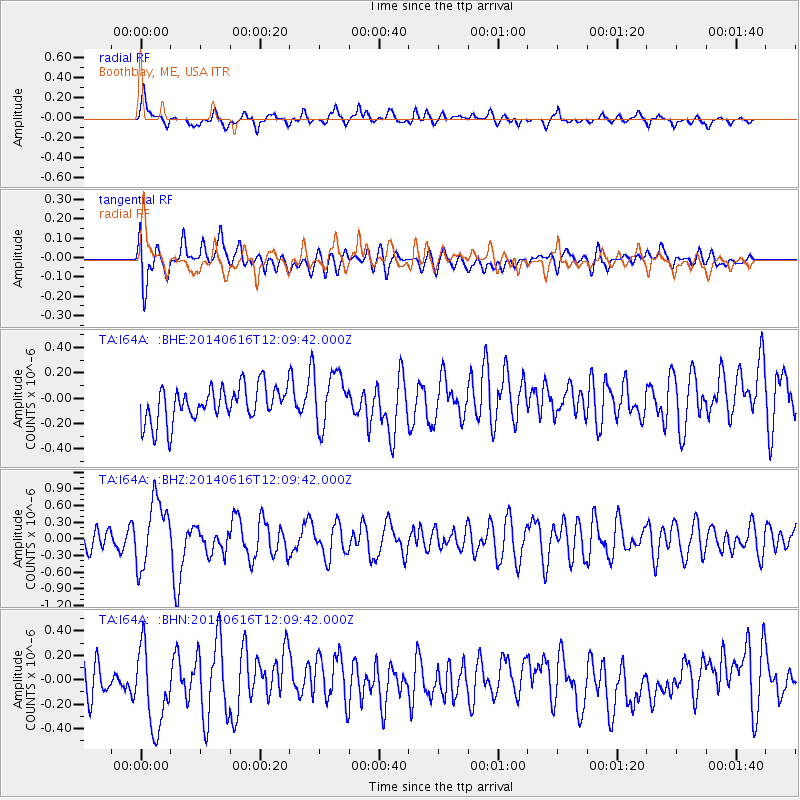
I64A Boothbay, ME, USA - Earthquake Result Viewer
*The percent match for this event was below the threshold and hence no stack was calculated.
| Earthquake location: |
Northern Alaska |
| Earthquake latitude/longitude: |
67.7/-162.0 |
| Earthquake time(UTC): |
2014/06/16 (167) 12:01:11 GMT |
| Earthquake Depth: |
16 km |
| Earthquake Magnitude: |
5.7 MB, 5.5 MWP, 5.5 MI |
| Earthquake Catalog/Contributor: |
NEIC PDE/NEIC COMCAT |
|
| Network: |
TA USArray Transportable Network (new EarthScope stations) |
| Station: |
I64A Boothbay, ME, USA |
| Lat/Lon: |
43.92 N/69.63 W |
| Elevation: |
17 m |
|
| Distance: |
51.1 deg |
| Az: |
68.025 deg |
| Baz: |
330.678 deg |
| Ray Param: |
$rayparam |
*The percent match for this event was below the threshold and hence was not used in the summary stack. |
|
| Radial Match: |
49.6432 % |
| Radial Bump: |
372 |
| Transverse Match: |
50.951523 % |
| Transverse Bump: |
400 |
| SOD ConfigId: |
739768 |
| Insert Time: |
2014-06-30 12:47:08.147 +0000 |
| GWidth: |
2.5 |
| Max Bumps: |
400 |
| Tol: |
0.001 |
|
Signal To Noise
| Channel | StoN | STA | LTA |
| TA:I64A: :BHZ:20140616T12:09:42.000Z | 2.8452184 | 5.9777136E-7 | 2.1009683E-7 |
| TA:I64A: :BHN:20140616T12:09:42.000Z | 2.0188043 | 3.3107747E-7 | 1.6399682E-7 |
| TA:I64A: :BHE:20140616T12:09:42.000Z | 1.5483088 | 2.1430301E-7 | 1.3841102E-7 |
| Arrivals |
| Ps | |
| PpPs | |
| PsPs/PpSs | |


