You are here: Home > Network List > TA - USArray Transportable Network (new EarthScope stations) Stations List
> Station J49A Marlette, MI, USA > Earthquake Result Viewer
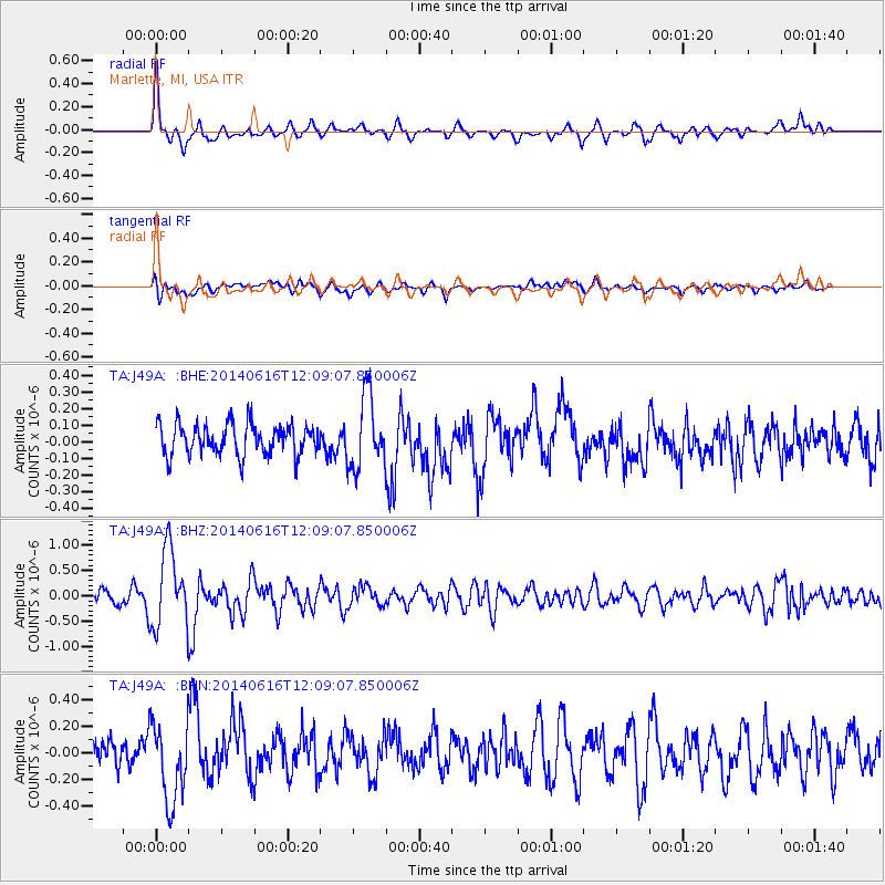
J49A Marlette, MI, USA - Earthquake Result Viewer
*The percent match for this event was below the threshold and hence no stack was calculated.
| Earthquake location: |
Northern Alaska |
| Earthquake latitude/longitude: |
67.7/-162.0 |
| Earthquake time(UTC): |
2014/06/16 (167) 12:01:11 GMT |
| Earthquake Depth: |
16 km |
| Earthquake Magnitude: |
5.7 MB, 5.5 MWP, 5.5 MI |
| Earthquake Catalog/Contributor: |
NEIC PDE/NEIC COMCAT |
|
| Network: |
TA USArray Transportable Network (new EarthScope stations) |
| Station: |
J49A Marlette, MI, USA |
| Lat/Lon: |
43.36 N/83.14 W |
| Elevation: |
253 m |
|
| Distance: |
46.7 deg |
| Az: |
79.639 deg |
| Baz: |
329.023 deg |
| Ray Param: |
$rayparam |
*The percent match for this event was below the threshold and hence was not used in the summary stack. |
|
| Radial Match: |
71.81231 % |
| Radial Bump: |
400 |
| Transverse Match: |
60.505184 % |
| Transverse Bump: |
400 |
| SOD ConfigId: |
739768 |
| Insert Time: |
2014-06-30 12:47:33.078 +0000 |
| GWidth: |
2.5 |
| Max Bumps: |
400 |
| Tol: |
0.001 |
|
Signal To Noise
| Channel | StoN | STA | LTA |
| TA:J49A: :BHZ:20140616T12:09:07.850006Z | 6.5890837 | 7.7012527E-7 | 1.16878965E-7 |
| TA:J49A: :BHN:20140616T12:09:07.850006Z | 2.8219986 | 2.9798906E-7 | 1.0559505E-7 |
| TA:J49A: :BHE:20140616T12:09:07.850006Z | 2.3195517 | 2.1541939E-7 | 9.2871126E-8 |
| Arrivals |
| Ps | |
| PpPs | |
| PsPs/PpSs | |


