You are here: Home > Network List > TA - USArray Transportable Network (new EarthScope stations) Stations List
> Station M53A WI Miller and Sons, Farmdale, OH, USA > Earthquake Result Viewer
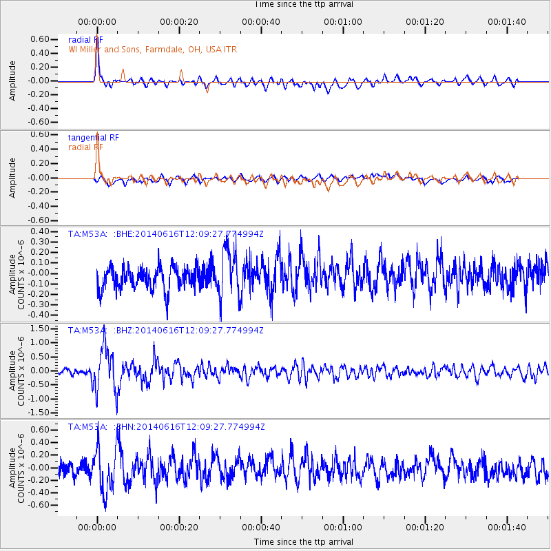
M53A WI Miller and Sons, Farmdale, OH, USA - Earthquake Result Viewer
*The percent match for this event was below the threshold and hence no stack was calculated.
| Earthquake location: |
Northern Alaska |
| Earthquake latitude/longitude: |
67.7/-162.0 |
| Earthquake time(UTC): |
2014/06/16 (167) 12:01:11 GMT |
| Earthquake Depth: |
16 km |
| Earthquake Magnitude: |
5.7 MB, 5.5 MWP, 5.5 MI |
| Earthquake Catalog/Contributor: |
NEIC PDE/NEIC COMCAT |
|
| Network: |
TA USArray Transportable Network (new EarthScope stations) |
| Station: |
M53A WI Miller and Sons, Farmdale, OH, USA |
| Lat/Lon: |
41.44 N/80.68 W |
| Elevation: |
334 m |
|
| Distance: |
49.3 deg |
| Az: |
78.829 deg |
| Baz: |
330.136 deg |
| Ray Param: |
$rayparam |
*The percent match for this event was below the threshold and hence was not used in the summary stack. |
|
| Radial Match: |
74.67361 % |
| Radial Bump: |
400 |
| Transverse Match: |
51.318256 % |
| Transverse Bump: |
400 |
| SOD ConfigId: |
739768 |
| Insert Time: |
2014-06-30 12:50:34.586 +0000 |
| GWidth: |
2.5 |
| Max Bumps: |
400 |
| Tol: |
0.001 |
|
Signal To Noise
| Channel | StoN | STA | LTA |
| TA:M53A: :BHZ:20140616T12:09:27.774994Z | 6.9703503 | 8.050465E-7 | 1.1549585E-7 |
| TA:M53A: :BHN:20140616T12:09:27.774994Z | 2.8004827 | 3.64477E-7 | 1.3014791E-7 |
| TA:M53A: :BHE:20140616T12:09:27.774994Z | 2.2433894 | 2.2841643E-7 | 1.0181756E-7 |
| Arrivals |
| Ps | |
| PpPs | |
| PsPs/PpSs | |


