You are here: Home > Network List > TA - USArray Transportable Network (new EarthScope stations) Stations List
> Station V61A Roper, NC, USA > Earthquake Result Viewer
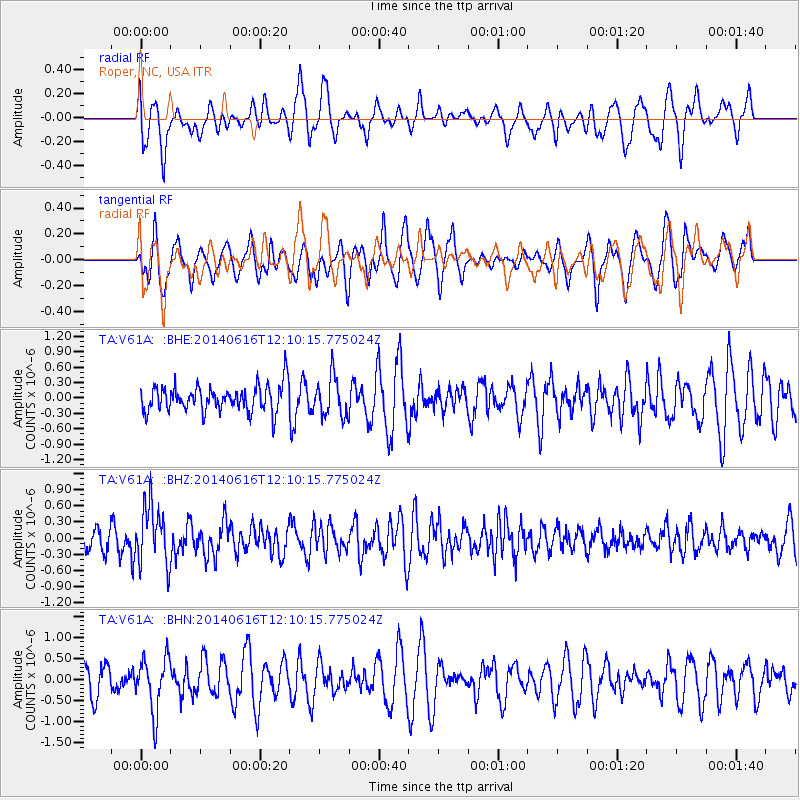
V61A Roper, NC, USA - Earthquake Result Viewer
*The percent match for this event was below the threshold and hence no stack was calculated.
| Earthquake location: |
Northern Alaska |
| Earthquake latitude/longitude: |
67.7/-162.0 |
| Earthquake time(UTC): |
2014/06/16 (167) 12:01:11 GMT |
| Earthquake Depth: |
16 km |
| Earthquake Magnitude: |
5.7 MB, 5.5 MWP, 5.5 MI |
| Earthquake Catalog/Contributor: |
NEIC PDE/NEIC COMCAT |
|
| Network: |
TA USArray Transportable Network (new EarthScope stations) |
| Station: |
V61A Roper, NC, USA |
| Lat/Lon: |
35.79 N/76.58 W |
| Elevation: |
4.0 m |
|
| Distance: |
55.7 deg |
| Az: |
78.681 deg |
| Baz: |
332.597 deg |
| Ray Param: |
$rayparam |
*The percent match for this event was below the threshold and hence was not used in the summary stack. |
|
| Radial Match: |
47.73801 % |
| Radial Bump: |
400 |
| Transverse Match: |
46.939 % |
| Transverse Bump: |
374 |
| SOD ConfigId: |
739768 |
| Insert Time: |
2014-06-30 12:57:39.960 +0000 |
| GWidth: |
2.5 |
| Max Bumps: |
400 |
| Tol: |
0.001 |
|
Signal To Noise
| Channel | StoN | STA | LTA |
| TA:V61A: :BHZ:20140616T12:10:15.775024Z | 2.8924012 | 5.496953E-7 | 1.900481E-7 |
| TA:V61A: :BHN:20140616T12:10:15.775024Z | 1.6781384 | 6.4144E-7 | 3.8223308E-7 |
| TA:V61A: :BHE:20140616T12:10:15.775024Z | 1.4774665 | 3.7745005E-7 | 2.5547115E-7 |
| Arrivals |
| Ps | |
| PpPs | |
| PsPs/PpSs | |


