You are here: Home > Network List > TA - USArray Transportable Network (new EarthScope stations) Stations List
> Station X43A Marvell, AR, USA > Earthquake Result Viewer
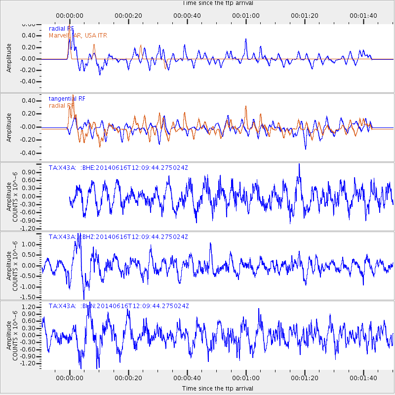
X43A Marvell, AR, USA - Earthquake Result Viewer
*The percent match for this event was below the threshold and hence no stack was calculated.
| Earthquake location: |
Northern Alaska |
| Earthquake latitude/longitude: |
67.7/-162.0 |
| Earthquake time(UTC): |
2014/06/16 (167) 12:01:11 GMT |
| Earthquake Depth: |
16 km |
| Earthquake Magnitude: |
5.7 MB, 5.5 MWP, 5.5 MI |
| Earthquake Catalog/Contributor: |
NEIC PDE/NEIC COMCAT |
|
| Network: |
TA USArray Transportable Network (new EarthScope stations) |
| Station: |
X43A Marvell, AR, USA |
| Lat/Lon: |
34.52 N/90.88 W |
| Elevation: |
53 m |
|
| Distance: |
51.4 deg |
| Az: |
92.326 deg |
| Baz: |
332.498 deg |
| Ray Param: |
$rayparam |
*The percent match for this event was below the threshold and hence was not used in the summary stack. |
|
| Radial Match: |
80.7962 % |
| Radial Bump: |
400 |
| Transverse Match: |
56.453514 % |
| Transverse Bump: |
400 |
| SOD ConfigId: |
739768 |
| Insert Time: |
2014-06-30 12:58:24.807 +0000 |
| GWidth: |
2.5 |
| Max Bumps: |
400 |
| Tol: |
0.001 |
|
Signal To Noise
| Channel | StoN | STA | LTA |
| TA:X43A: :BHZ:20140616T12:09:44.275024Z | 3.9764087 | 8.9094607E-7 | 2.2405796E-7 |
| TA:X43A: :BHN:20140616T12:09:44.275024Z | 1.8862599 | 5.81821E-7 | 3.0845217E-7 |
| TA:X43A: :BHE:20140616T12:09:44.275024Z | 1.0716085 | 3.6195405E-7 | 3.3776703E-7 |
| Arrivals |
| Ps | |
| PpPs | |
| PsPs/PpSs | |


