You are here: Home > Network List > TA - USArray Transportable Network (new EarthScope stations) Stations List
> Station I23K Minto, Yukon-Koyukuk, AK, USA > Earthquake Result Viewer
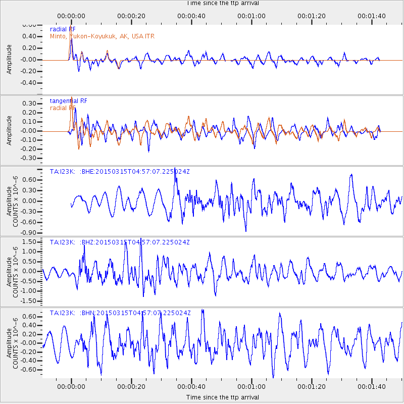
I23K Minto, Yukon-Koyukuk, AK, USA - Earthquake Result Viewer
*The percent match for this event was below the threshold and hence no stack was calculated.
| Earthquake location: |
Mariana Islands |
| Earthquake latitude/longitude: |
18.7/146.4 |
| Earthquake time(UTC): |
2015/03/15 (074) 04:47:21 GMT |
| Earthquake Depth: |
58 km |
| Earthquake Magnitude: |
5.8 MO |
| Earthquake Catalog/Contributor: |
NEIC PDE/NEIC ALERT |
|
| Network: |
TA USArray Transportable Network (new EarthScope stations) |
| Station: |
I23K Minto, Yukon-Koyukuk, AK, USA |
| Lat/Lon: |
65.15 N/149.36 W |
| Elevation: |
149 m |
|
| Distance: |
62.4 deg |
| Az: |
25.431 deg |
| Baz: |
254.372 deg |
| Ray Param: |
$rayparam |
*The percent match for this event was below the threshold and hence was not used in the summary stack. |
|
| Radial Match: |
52.923424 % |
| Radial Bump: |
307 |
| Transverse Match: |
60.88418 % |
| Transverse Bump: |
379 |
| SOD ConfigId: |
7422571 |
| Insert Time: |
2019-04-17 18:51:07.092 +0000 |
| GWidth: |
2.5 |
| Max Bumps: |
400 |
| Tol: |
0.001 |
|
Signal To Noise
| Channel | StoN | STA | LTA |
| TA:I23K: :BHZ:20150315T04:57:07.225024Z | 2.0361845 | 4.7391404E-7 | 2.327461E-7 |
| TA:I23K: :BHN:20150315T04:57:07.225024Z | 1.0043437 | 1.6285564E-7 | 1.6215131E-7 |
| TA:I23K: :BHE:20150315T04:57:07.225024Z | 1.9521135 | 3.9364787E-7 | 2.0165214E-7 |
| Arrivals |
| Ps | |
| PpPs | |
| PsPs/PpSs | |


